Area Overview for Neath
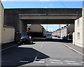
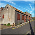
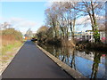
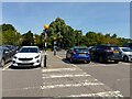
Photos of Neath


Area Information
Neath is a compact built-up area in Wales, covering 11.1 km² and home to 5,926 residents. Its population density of 534 people per square kilometre suggests a closely knit community, with a median age of 70 indicating a predominantly older demographic. The area’s proximity to major transport routes and nearby towns makes it a practical choice for those seeking a balance between urban convenience and a quieter lifestyle. Neath’s charm lies in its accessibility—rail links to Neath, Skewen, and Briton Ferry stations provide easy connections to surrounding regions, while the Swansea Queens Dock Ferry Terminal offers water-based travel options. The town’s retail scene includes Aldi Neath, Tesco Neath, and Morrisons Llantwit, ensuring daily essentials are within reach. For families, a range of primary and junior schools are nearby, including Blaenhonddan Primary School and Coedffranc Infant School, supporting local education needs. Neath’s character is defined by its community-focused amenities and straightforward infrastructure, appealing to those prioritising practicality and connectivity over sprawling urban sprawl.
- Area Type
- Built Up Area 250
- Area Size
- 11.1 km²
- Population
- 5926
- Population Density
- 534 people/km²
Living in Neath offers access to a range of amenities within practical reach. The retail sector includes well-known stores such as Aldi Neath, Tesco Neath, and Morrisons Llantwit, providing essential shopping options. The area’s rail network, with stations like Neath and Briton Ferry, facilitates easy travel to surrounding regions, while the Swansea Queens Dock Ferry Terminal adds flexibility for those preferring water-based transport. Though the data does not specify parks or leisure facilities, the presence of multiple retail and transport hubs suggests a community focused on convenience and accessibility. The mix of shops, transport links, and nearby schools creates a lifestyle that prioritises practicality, making Neath suitable for those who value straightforward infrastructure and local connectivity over expansive recreational spaces.
Amenities
Schools
Neath is served by several educational institutions, including Blaenhonddan Primary School, Coedffranc Junior School, Coedffranc Infant School, Gnoll Primary School, and Catwg Primary School. These schools cater to a range of age groups, from early years to primary education, providing families with multiple options for their children’s schooling. While the data does not include Ofsted ratings or specific academic performance metrics, the presence of both infant and junior schools suggests a structured approach to education in the area. For parents prioritising proximity to schools, Neath’s network of primary institutions offers convenience, with many located within walking or short driving distance. The diversity of school names and types may reflect local community needs, though without detailed ratings or curriculum information, families may need to conduct additional research to assess the quality of education available.
| Rank | School | Type | Entry gender | Ages |
|---|
Explore more schools in this area
Go to Schools tabDemographics
Neath’s population skews older, with a median age of 70, suggesting a community where retirement and long-term residency are common. Home ownership stands at 65%, indicating a stable housing market with a significant proportion of residents owning their properties. The data does not specify household composition or accommodation types, but the overall figure of 65% ownership implies a mix of long-term residents and fewer rental properties. The area’s demographic profile is shaped by its age profile, with no specific data on ethnic diversity or religious composition provided. This older demographic may influence local services and amenities, with a focus on healthcare and community centres. While the data does not include deprivation metrics, the population density and ownership rates suggest a self-sufficient community, though the lack of detailed breakdowns on household types or diversity means broader social dynamics remain unexplored.
Household Size
Accommodation Type
Tenure
Ethnic Group
Religion
Household Composition
Age
Household Deprivation
NS-SEC
Explore more demographic insights in this area
Go to Demographics tabPlanning
Planning Constraints
- Crime RiskPremium