Area Overview for Cwmllynfell Community
Photos of Cwmllynfell Community
Area Information
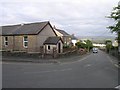
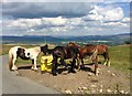
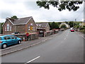
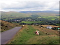
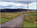
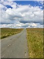
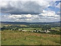
Cwmllynfell Community sits as a distinct parish within Neath Port Talbot county borough in Wales. You will find this civil parish occupying 9.3 km² on the western edge of the Brecon Beacons. The village lies in the Twrch Valley roughly 16 miles north-east of Swansea. Daily life here revolves around a tight-knit rural setting defined by its historic chapels and community halls. A 4.6 magnitude earthquake struck on 17 February 2018, marking the largest seismic event in the British Isles since 2008. While the recent tremor was significant, the area has a deep connection to Welsh Nonconformism, with the first independent chapel constructed on the river banks as early as 1701. Residents enjoy scenic views of the Black Mountain which borders the parish. Your days are likely spent in a village that maintains traditional amenities, from a rugby union team to a bilingual primary school. The community centre, Neuadd Cwmllynfell Hall, serves as a hub for social activities on the site of a former Miners Welfare Hall. Living in Cwmllynfell Community means embracing a lifestyle where history and nature intersect without the noise of a major city.
- Area Type
- Parish
- Area Size
- 9.3 km²
- Population
- Not available
- Population Density
- Not available
Demographics
People living in Cwmllynfell Community represent a settled population with specific characteristics. The median age for residents is 70, indicating a demographic skewed significantly towards older adults. This data point highlights a community where retirement and long-term residency define the social fabric. Home ownership levels stand at 79 per cent, suggesting the majority of households own their properties outright or through mortgage. This high rate of ownership typically stabilises the local market and reduces the proportion of short-term rentals. While specific breakdowns for household composition, ethnic group, and religion are not detailed in the current records, the overall profile points to a traditional Welsh village. You should expect a quiet environment where the older generation dominates the street scene. The high ownership percentage implies that changing landlords within individual homes is less common than in larger urban parishes. When you look at homes in Cwmllynfell Community, you are entering an area where residents have put down roots. The demographic reality is clear: this is a village for those who prefer stability over transient living.
Household Size
Accommodation Type
Tenure
Ethnic Group
Religion
Household Composition
Age
Household Deprivation
NS-SEC
Explore more demographic insights in this area
Go to Demographics tabPlanning
Planning Constraints
- Flood RiskPremium
- Ramsar Wetland SitesPremium
- Area of Outstanding Natural BeautyPremium
- Protected Nature ReservePremium
- Protected WoodlandPremium
- Crime RiskPremium