Area Overview for Crynant Community
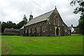
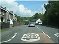
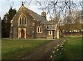
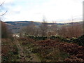
Photos of Crynant Community
Area Information
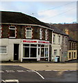
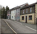
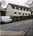
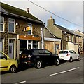
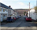
Living in Crynant Community offers a distinct experience defined by its status as a civil parish within Wales. The area covers a substantial 21.7 km², providing enough space for residents to enjoy a quiet, rural setting without feeling entirely isolated. This parish attracts specific buyers seeking a departure from city noise, yet the community retains enough local identity to ensure daily needs are met within a familiar environment. When you consider homes in Crynant Community, you are stepping into a location where the natural landscape dictates the pace of life. The size of the parish allows for established neighbourhoods that have developed organically over time. You will find that daily routines here involve appreciating the wide skies and open views rather than navigating crowded high streets. The community functions as a self-contained unit where property ownership rates are notably high, suggesting long-term stability and strong local roots. Prospective buyers looking for somewhere to establish a permanent base will find the geography of Crynant Community supportive of a slower, more sustainable lifestyle. The balance between rural privacy and available infrastructure defines the character of this Welsh parish, making it a viable option for those prioritising space and tranquility.
- Area Type
- Parish
- Area Size
- 21.7 km²
- Population
- Not available
- Population Density
- Not available
Demographics
The people who call Crynant Community home skews significantly older than the national average, with a median age of 70. This demographic profile indicates a retirement-oriented environment where retirees settle down for the long term. You will find that the population is concentrated in the older age bracket, which shapes local facilities and community events around the needs of seniors. With 70% of residents owning their homes, the area reflects a generation that has stayed put or moved here with the intention of growing old in peace. This high rate of home ownership contrasts sharply with rental-heavy markets elsewhere, creating a stable residential fabric. The household composition in Crynant Community suggests large families or empty nesters rather than young professionals commuting daily. When you evaluate life in this parish, the age profile means local businesses cater primarily to mature consumers. The lack of data regarding specific ethnic diversity or religious makeup means these community facets remain less visible statistically, but the overwhelming age statistic clearly defines the social dynamic. You are joining a community where life moves at the speed of the older generation, prioritising comfort and stability over rapid change.
Household Size
Accommodation Type
Tenure
Ethnic Group
Religion
Household Composition
Age
Household Deprivation
NS-SEC
Explore more demographic insights in this area
Go to Demographics tabPlanning
Planning Constraints
- Flood RiskPremium
- Ramsar Wetland SitesPremium
- Area of Outstanding Natural BeautyPremium
- Protected Nature ReservePremium
- Protected WoodlandPremium
- Crime RiskPremium