Area Overview for Sandfields West Community
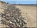
Photos of Sandfields West Community


Area Information
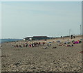
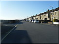
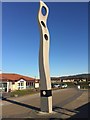
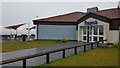
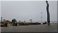
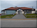
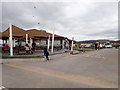
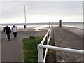
Living in Sandfields West Community means residing within a unitary electoral division that encompasses 2.3 square kilometres of the Neath Port Talbot built-up area. This locality sits at the heart of a post-war development story, specifically near Aberavon Beach and the Sandfields estate, which was established to support the local steel industry. The area carries a distinct historical weight, having been developed after the Second World War with the clearance of dunes to make way for housing in 1951. Construction of nearly 900 houses continued for 25 years, creating a dense residential fabric that defines daily life today. You are standing on ground where prefabs were erected between 1951 and 1952, marking a significant shift in local demographics. The community is anchored by educational institutions with deep roots; Sandfields Infant School has operated since 1895, while Sandfields Comprehensive opened in 1958. Glanymor first school also began in 1951 on the estate itself. Cultural life revolves around the Sandfields Library, which serves as the base for the Port Talbot Historical Society founded in 1954. The estate remains celebrated for its industrial past, having been the subject of a touring exhibition dedicated to its connection with the steelworks. When you look at maps using coordinates 51.601651898419995, -3.8238291992135363, you identify a space that blends history with modern domestic life. Homes in Sandfields West Community reflect this layered history, offering a setting deeply connected to the region's industrial heritage while serving as a residential hub for current families and residents.
- Area Type
- Parish
- Area Size
- 2.3 km²
- Population
- Not available
- Population Density
- Not available
Demographics
The demographic profile of Sandfields West Community is dominated by an older population, with a median age of 70. This figure indicates that the area is home to a significant number of retirees. The most common age range recorded in the data is simply listed as 'Age: Total', which reflects a broad spread without a specific narrow peak other than the high median. House ownership stands at a precise rate of 51% of the total household composition. This means you are almost as likely to find an owner-occupied property as you are to find a rental property in Sandfields West Community. The remaining 49% of households consist of tenants. The data does not specify the breakdown of household compositions beyond the total, nor does it specify the predominant ethnic group or religious affiliations in detail. You do not have granular statistics on family sizes or single-person households in Sandfields West Community. Despite the high median age, the area has maintained active community institutions for decades. The presence of a comprehensive school serving the area suggests that families with children do reside here, potentially drawn by the specific catchment areas of Sandfields Comprehensive and the nearby Sandfields Infant School. While the median age suggests a quiet atmosphere, the lack of detailed age banding prevents a full picture of youth and working-age population sizes. You must rely on the 51% ownership figure to gauge stability in this section of Port Talbot. The community reflects a transition period between an industrial workforce history and a retirement-heavy demographic reality.
Household Size
Accommodation Type
Tenure
Ethnic Group
Religion
Household Composition
Age
Household Deprivation
NS-SEC
Explore more demographic insights in this area
Go to Demographics tabPlanning
Planning Constraints
- Flood RiskPremium
- Ramsar Wetland SitesPremium
- Area of Outstanding Natural BeautyPremium
- Protected Nature ReservePremium
- Protected WoodlandPremium
- Crime RiskPremium