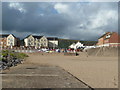
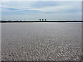
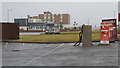
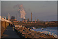
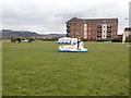
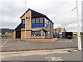
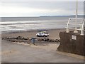
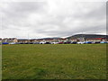
Area Overview for Sandfields East Community
Photos of Sandfields East Community


Area Information
Sandfields East Community is a small civil parish situated in Wales. You will live in a compact area covering just 2.2 km². The community houses a population of 1723 people. This results in a population density of 790 people per square kilometre. Such density creates a neighbourhood where neighbours are close together but the footprint remains small. Living in Sandfields East Community means experiencing a settled environment rather than a sprawling development. The parish status indicates a level of local governance and community identity that persists in rural settings. You buy into a space defined by its size and historical administrative boundaries. Daily life here involves navigating a defined perimeter with clear geographic limits. The compact nature of the parish suggests efficient use of land resources. Residents benefit from a sense of proximity without the congestion of larger towns. Your everyday journey involves moving across a familiar landscape of roughly two square kilometres. This small scale allows for quick access to local points of interest. The civil parish structure provides a framework for shared responsibility among the 1723 locals. You are purchasing a stake in a distinct and measurable piece of Wales. ### The community in Sandfields East Community reflects a landscape where half of the adults are over the age of 60. This means the median age sits at 70 years. Most households will likely contain older residents or retired couples. Home ownership stands at 53 per cent of all properties. This figure indicates that slightly more than half of the residents own their homes outright or with a mortgage. The remaining 47 per cent consist of renters or those in shared ownership schemes. You will find a stable resident base rather than a high turnover of tenants. The household composition data confirms that the area is dominated by established demographics. There are no records of specific predominant ethnic groups or religious affiliations available for this parish. This lack of specific diversity data suggests a community where local traditions may be significant. Deprivation levels are not recorded in the current dataset for this location. Consequently, you cannot judge the economic status of the area using standard indices. The demographic profile points to a quiet settlement with a clear age cap. When considering living in Sandfields East Community, expect a population that has reached a later stage in life. The absence of young family statistics further supports the view of a mature neighbourhood. ### The property market in Sandfields East Community is defined by a significant owner-occupier presence. Exactly 53 per cent of the housing stock is registered as owner-occupied. This suggests that investing in homes in Sandfields East Community often leads to long-term residency. You are more likely to meet owners who have lived in the area for many years than frequent renters. The accommodation type data categorises the total housing stock without breaking it down by specific property styles like detached or terraced. Therefore, you must verify the specific physical attributes of any individual house for sale. The low population of 1723 within a 2.2 km² area limits the sheer volume of listings available. Supply in the parish is finite compared to larger urban districts. Buying here typically means securing a property within a very small local circle. The stability derived from high home ownership rates creates a predictable market environment. There is no evidence of a volatile rental sector dominating the landscape. Your purchase will join a larger majority of owned properties. The market does not reflect a city centre dynamic but rather a settled residential pattern. ### Digital connectivity is one of the strongest infrastructure features for living in Sandfields East Community. The fixed broadband quality score reaches 97 out of 100. You can categorise this connection level as excellent for almost all internet-dependent tasks. High-speed fibre or full fibre lines should perform flawlessly for video calls or streaming. Mobile network quality scores 83 out of 100 for this parish. This rating classifies as good performance for general browsing, social media, and navigation apps. You will experience reliable coverage for daily communication needs. Working from home in Sandfields East Community benefits from these superior digital ratings. The infrastructure supports remote employment patterns without interruption. Signal drops during peak usage times are unlikely given the high scores. Residents do not face common connectivity struggles found in other rural Welsh areas. The digital landscape here matches the performance of much denser urban centres. Your reliance on technology for work, education, and leisure is fully supported. There are no constraints on bandwidth that would hinder heavy file transfers or cloud syncing. ### Environmental and safety assessments for Sandfields East Community show a clear lack of major planning constraints. The flood risk score is 2.78, which indicates very low flood risk coverage across the parish. You do not face significant danger from water saturation during heavy rainfall events. The level is classified as pass regarding flood liability. No Ramsar wetland sites exist within the area boundaries. This means there are no internationally protected wetlands that restrict building or development. The area of outstanding natural beauty coverage is zero. Consequently, planning restrictions associated with AONB status do not apply to this 2.2 km² parish. Protected nature reserves and protected woodland are also absent from the local map. These factors simplify the planning constraints for anyone looking to acquire land. The crime risk assessment notes that crime data is currently only available for areas in England. This specific restriction means you have no official crime statistics to review for Sandfields East Community. While this gap prevents a statistical safety rating, the environmental safety posts remain excellent. You live in a location with minimal physical planning red tape and low hydrological risk. ### What is the size and population of Sandfields East Community?Sandfields East Community covers 2.2 km² and has a population of 1723 people. This results in a density of 790 people per square kilometre. The area is a civil parish in Wales, meaning it is a small, defined administrative unit rather than a large town. Living in such a compact space means you are surrounded by neighbours across a very short distance. How old is the typical resident in Sandfields East Community?The median age in Sandfields East Community is 70 years. This indicates that the community is dominated by older residents. Over half of the households likely consist of older adults or retirees. The demographic data does not provide specific breakdowns for younger age groups, suggesting a mature population profile. You can expect a quieter atmosphere compared to districts with younger families. Is the internet and mobile coverage reliable in Sandfields East Community?Digital connectivity in Sandfields East Community is excellent. Fixed broadband scores 97 out of 100, providing top-tier speed for home working. Mobile coverage scores 83 out of 100, classified as good. These figures mean you can expect stable connections for all residents. There are no connectivity issues that would hinder remote work or daily online activities in this parish. Are there safety concerns or planning restrictions for living in Sandfields East Community?Risk assessments for Sandfields East Community indicate very low exposure to environmental hazards. Flood risk is low with a score of 2.78. There are no Ramsar wetland sites, areas of outstanding natural beauty, protected nature reserves, or protected woodland within the parish boundaries. While official crime data is currently unavailable for this Welsh location, the lack of ecological planning constraints simplifies the local environment.
- Area Type
- Parish
- Area Size
- 2.2 km²
- Population
- 1723
- Population Density
- 790 people/km²
Demographics
The community in Sandfields East Community reflects a landscape where half of the adults are over the age of 60. This means the median age sits at 70 years. Most households will likely contain older residents or retired couples. Home ownership stands at 53 per cent of all properties. This figure indicates that slightly more than half of the residents own their homes outright or with a mortgage. The remaining 47 per cent consist of renters or those in shared ownership schemes. You will find a stable resident base rather than a high turnover of tenants. The household composition data confirms that the area is dominated by established demographics. There are no records of specific predominant ethnic groups or religious affiliations available for this parish. This lack of specific diversity data suggests a community where local traditions may be significant. Deprivation levels are not recorded in the current dataset for this location. Consequently, you cannot judge the economic status of the area using standard indices. The demographic profile points to a quiet settlement with a clear age cap. When considering living in Sandfields East Community, expect a population that has reached a later stage in life. The absence of young family statistics further supports the view of a mature neighbourhood. ### The property market in Sandfields East Community is defined by a significant owner-occupier presence. Exactly 53 per cent of the housing stock is registered as owner-occupied. This suggests that investing in homes in Sandfields East Community often leads to long-term residency. You are more likely to meet owners who have lived in the area for many years than frequent renters. The accommodation type data categorises the total housing stock without breaking it down by specific property styles like detached or terraced. Therefore, you must verify the specific physical attributes of any individual house for sale. The low population of 1723 within a 2.2 km² area limits the sheer volume of listings available. Supply in the parish is finite compared to larger urban districts. Buying here typically means securing a property within a very small local circle. The stability derived from high home ownership rates creates a predictable market environment. There is no evidence of a volatile rental sector dominating the landscape. Your purchase will join a larger majority of owned properties. The market does not reflect a city centre dynamic but rather a settled residential pattern. ### Digital connectivity is one of the strongest infrastructure features for living in Sandfields East Community. The fixed broadband quality score reaches 97 out of 100. You can categorise this connection level as excellent for almost all internet-dependent tasks. High-speed fibre or full fibre lines should perform flawlessly for video calls or streaming. Mobile network quality scores 83 out of 100 for this parish. This rating classifies as good performance for general browsing, social media, and navigation apps. You will experience reliable coverage for daily communication needs. Working from home in Sandfields East Community benefits from these superior digital ratings. The infrastructure supports remote employment patterns without interruption. Signal drops during peak usage times are unlikely given the high scores. Residents do not face common connectivity struggles found in other rural Welsh areas. The digital landscape here matches the performance of much denser urban centres. Your reliance on technology for work, education, and leisure is fully supported. There are no constraints on bandwidth that would hinder heavy file transfers or cloud syncing. ### Environmental and safety assessments for Sandfields East Community show a clear lack of major planning constraints. The flood risk score is 2.78, which indicates very low flood risk coverage across the parish. You do not face significant danger from water saturation during heavy rainfall events. The level is classified as pass regarding flood liability. No Ramsar wetland sites exist within the area boundaries. This means there are no internationally protected wetlands that restrict building or development. The area of outstanding natural beauty coverage is zero. Consequently, planning restrictions associated with AONB status do not apply to this 2.2 km² parish. Protected nature reserves and protected woodland are also absent from the local map. These factors simplify the planning constraints for anyone looking to acquire land. The crime risk assessment notes that crime data is currently only available for areas in England. This specific restriction means you have no official crime statistics to review for Sandfields East Community. While this gap prevents a statistical safety rating, the environmental safety posts remain excellent. You live in a location with minimal physical planning red tape and low hydrological risk. ### What is the size and population of Sandfields East Community?Sandfields East Community covers 2.2 km² and has a population of 1723 people. This results in a density of 790 people per square kilometre. The area is a civil parish in Wales, meaning it is a small, defined administrative unit rather than a large town. Living in such a compact space means you are surrounded by neighbours across a very short distance. How old is the typical resident in Sandfields East Community?The median age in Sandfields East Community is 70 years. This indicates that the community is dominated by older residents. Over half of the households likely consist of older adults or retirees. The demographic data does not provide specific breakdowns for younger age groups, suggesting a mature population profile. You can expect a quieter atmosphere compared to districts with younger families. Is the internet and mobile coverage reliable in Sandfields East Community?Digital connectivity in Sandfields East Community is excellent. Fixed broadband scores 97 out of 100, providing top-tier speed for home working. Mobile coverage scores 83 out of 100, classified as good. These figures mean you can expect stable connections for all residents. There are no connectivity issues that would hinder remote work or daily online activities in this parish. Are there safety concerns or planning restrictions for living in Sandfields East Community?Risk assessments for Sandfields East Community indicate very low exposure to environmental hazards. Flood risk is low with a score of 2.78. There are no Ramsar wetland sites, areas of outstanding natural beauty, protected nature reserves, or protected woodland within the parish boundaries. While official crime data is currently unavailable for this Welsh location, the lack of ecological planning constraints simplifies the local environment.
Household Size
Accommodation Type
Tenure
Ethnic Group
Religion
Household Composition
Age
Household Deprivation
NS-SEC
Explore more demographic insights in this area
Go to Demographics tabPlanning
Planning Constraints
- Flood RiskPremium
- Ramsar Wetland SitesPremium
- Area of Outstanding Natural BeautyPremium
- Protected Nature ReservePremium
- Protected WoodlandPremium
- Crime RiskPremium