Area Overview for Pontardawe Community
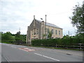
Photos of Pontardawe Community


Area Information
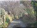
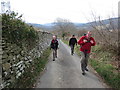
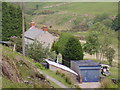
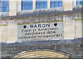
Pontardawe Community sits on the north-western bank of the River Tawe in the Swansea Valley, Neath Port Talbot. This civil parish spans 31.0 km² and holds a population of 2,179 people. The settlement earned its name as "the bridge on the Tawe" when it first appeared on a map in 1729. An old stone bridge built by William Edwards of Pontypridd stands as a historical marker from around 1757. Industrial activity defined the area through the Swansea Canal, opened in 1796, and Ynysderw ironworks which began operations in 1835. Tinplate and steelworks later established the local economy in the late 19th century. A railway line from Swansea reached the community in 1860, connecting to the national network by 1873. Passenger services on this line ceased by 1950. You now live in a place where a historic crossing of drovers' roads meets modern quiet streets. The wider town area contains approximately 5,000 inhabitants, but you reside within the distinct boundaries of this specific parish.
- Area Type
- Parish
- Area Size
- 31.0 km²
- Population
- 2179
- Population Density
- 70 people/km²
Demographics
The people of Pontardawe Community represent a settled population with clear demographic patterns. The median age for residents here is 70 years, indicating a significant proportion of older adults calling this parish home. This age profile suggests a community built on longevity rather than rapid population turnover. Home ownership stands at a high rate of 72% within the area. This figure reveals that the vast majority of households in Pontardawe Community own their own homes. When you consider the area size of 31.0 km² and the total population of 2,179, you find a low-density residential environment. The household composition data reflects a total count of units without specifying split between families or lone occupants, yet the high ownership rate points to long-term residents. Accommodation types are described as a total aggregate for the parish. You encounter a neighbourhood where tenure stability is the primary characteristic. No data is provided on specific ethnic groups or religious affiliations, so the demography relies on these age and ownership metrics.
Household Size
Accommodation Type
Tenure
Ethnic Group
Religion
Household Composition
Age
Household Deprivation
NS-SEC
Explore more demographic insights in this area
Go to Demographics tabPlanning
Planning Constraints
- Flood RiskPremium
- Ramsar Wetland SitesPremium
- Area of Outstanding Natural BeautyPremium
- Protected Nature ReservePremium
- Protected WoodlandPremium
- Crime RiskPremium