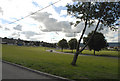
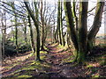
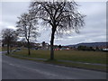
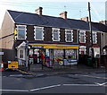
Area Overview for Neath Community
Photos of Neath Community


Area Information
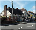
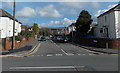
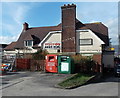
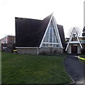
Neath Community sits within the County Borough of Neath Port Talbot in South Wales, covering an area of 10.3 km². Its population stands at 11,322, creating a residential density of 1,095 people per square kilometre. You will find yourself in a civil parish defined by deep historical roots, having originated as a monastic settlement founded by St Illtyd in the 6th century. The River Neath runs through the parish, shaping its identity from a pre-Norman Welsh royal village to a major Norman settlement. Neath Abbey, founded in 1130, remains a significant landmark, while the Old Town Hall, erected in 1820–21, serves as a modern civic venue. Daily life here offers proximity to these historical sites, including Neath Castle and the Church of St Illtyd. Living in Neath Community means engaging with a town that balances its medieval past with contemporary residential needs. The area provides a clear sense of place, anchored by its geography and heritage rather than generic urban development. You are part of a community where the physical layout reflects centuries of evolution, offering a distinct character that differs from large suburban sprawls.
- Area Type
- Parish
- Area Size
- 10.3 km²
- Population
- 11322
- Population Density
- 1095 people/km²
Demographics
The social profile of Neath Community reflects an established settlement with a significant proportion of older residents. The median age is 70 years, indicating a population skewed towards the elderly. This age distribution suggests that homes in Neath Community are often suited to retirees or those seeking quiet neighbourhoods away from the bustle of younger family clusters. Home ownership levels stand at 62%, meaning the majority of households own their property outright or have a mortgage, rather than renting. This high ownership rate typically points to long-term residency and stability within the parish. Accommodation types and household composition data are aggregated rather than broken down by specific demographic slices, but the overall picture points towards a settled community. The area does not show data for predominant ethnic groups or religious breakdowns in the provided statistics, but the historical context of a Church in Wales structure like the Church of St Illtyd implies a traditional religious footprint. You should anticipate a neighbourhood where routine social interactions are common among long-term residents. Buying property here often means joining an existing, fluid social fabric rather than a transient population.
Household Size
Accommodation Type
Tenure
Ethnic Group
Religion
Household Composition
Age
Household Deprivation
NS-SEC
Explore more demographic insights in this area
Go to Demographics tabPlanning
Planning Constraints
- Flood RiskPremium
- Ramsar Wetland SitesPremium
- Area of Outstanding Natural BeautyPremium
- Protected Nature ReservePremium
- Protected WoodlandPremium
- Crime RiskPremium