Area Overview for Glynneath Community
Photos of Glynneath Community
Area Information
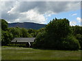
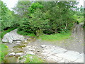
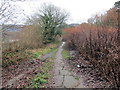
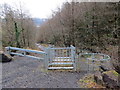
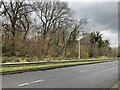
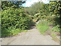
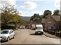
Living in Glynneath Community offers a distinct experience within the Welsh landscape, defined by its status as a civil parish covering an area of 26.2 square kilometres. This parish presents a quiet setting where residents can expect a traditional village rhythm rather than urban pace. You will find no Ramsar wetland sites or Areas of Outstanding Natural Beauty within the parish boundaries, which simplifies planning considerations for potential buyers looking at homes in Glynneath Community. However, the presence of protected nature reserves and protected woodland means that expansion is carefully managed to preserve local green spaces. The character of the area is shaped by these environmental factors, creating a setting where the natural environment plays a tangible role in the daily lives of those settling here. When considering homes in Glynneath Community, you are purchasing a share of this specific 26.2 km² expanse, balancing residential needs with the constraints of local conservation areas. The parish structure provides a recognised administrative framework, ensuring that local governance operates within a defined geographical scope that residents can relate to.
- Area Type
- Parish
- Area Size
- 26.2 km²
- Population
- Not available
- Population Density
- Not available
Demographics
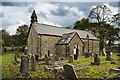
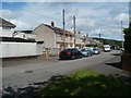
The community in Glynneath Community presents a clear demographic profile characterised by an older population. The median age stands at 70 years, indicating that the typical resident is significantly older than the national average. While specific data is unavailable for detailed age breakdowns beyond this median figure, the area functions primarily as a settlement for those in later life. Home ownership is the dominant household arrangement, with 67% of residents owning their properties outright or with a mortgage. This high level of ownership suggests a stable community where residents have established long-term roots. The available data does not provide specific figures for household composition, accommodation types, or predominant ethnic groups, so we cannot make claims about diversity or family sizes within the parish. Instead, the demographic picture is one of a homeownership-led community where the average resident is a senior citizen. This age profile influences local services and amenities, shaping the daily environment for those living in Glynneath Community.
Household Size
Accommodation Type
Tenure
Ethnic Group
Religion
Household Composition
Age
Household Deprivation
NS-SEC
Explore more demographic insights in this area
Go to Demographics tabPlanning
Planning Constraints
- Flood RiskPremium
- Ramsar Wetland SitesPremium
- Area of Outstanding Natural BeautyPremium
- Protected Nature ReservePremium
- Protected WoodlandPremium
- Crime RiskPremium