Area Overview for Shirenewton
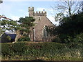
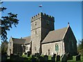
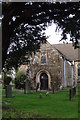
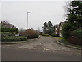
Photos of Shirenewton


Area Information
Shirenewton, a built-up area in Wales, spans 24.5 hectares and sits within a landscape shaped by its proximity to nearby towns and rural surroundings. The area’s demographic profile is distinct, with a median age of 70, reflecting a community that is predominantly older. This suggests a population with established roots, likely drawn to the area for its quiet, settled character. While the exact composition of households and accommodation types is not specified, the high home ownership rate of 88% indicates a strong sense of permanence. Living in Shirenewton means access to practical amenities, including five retail outlets such as Spar, M&S Chepstow, and Aldi Wesley, as well as three rail stations—Chepstow, Caldicot, and Severn Tunnel Junction. These connections to transport and shopping make it a convenient base for those seeking a balance between local convenience and regional accessibility. The area’s compact size and proximity to rail links suggest it is well-suited for commuters or those prioritising ease of movement. For buyers considering homes in Shirenewton, the blend of stability, local amenities, and transport options offers a straightforward, no-frills lifestyle.
- Area Type
- Built Up Area 250
- Area Size
- 24.5 hectares
- Population
- Not available
- Population Density
- Not available
Living in Shirenewton offers access to a range of nearby amenities that support daily life. The area is served by five retail outlets, including Spar, M&S Chepstow, and Aldi Wesley, providing convenience for shopping and household needs. These stores are likely to cater to the area’s older demographic with practical, everyday products. The three rail stations—Chepstow, Caldicot, and Severn Tunnel Junction—offer reliable transport options, connecting residents to broader regional networks for work, leisure, or travel. While the data does not specify parks or recreational facilities, the presence of rail links and retail options suggests a lifestyle that balances local convenience with regional accessibility. For residents, this means a practical, low-maintenance environment where essential services are within reach. The absence of detailed information on green spaces or leisure facilities means that those prioritising outdoor activities may need to look further afield, but the existing amenities provide a solid foundation for daily living.
Amenities
Schools
| Rank | School | Type | Entry gender | Ages |
|---|
Explore more schools in this area
Go to Schools tabDemographics
The population of Shirenewton is characterised by a median age of 70, with the most common age range encompassing all age groups. This suggests a community that is largely composed of older residents, potentially including retirees or long-term residents. Home ownership is exceptionally high at 88%, indicating that most households are owner-occupied rather than renting. This figure underscores a stable, settled population with long-term ties to the area. While the data does not specify household composition or ethnic diversity, the high home ownership rate implies a low turnover of residents and a strong local identity. The absence of detailed figures on deprivation or diversity means that the area’s socioeconomic profile remains partially unexplored, but the high ownership rate alone suggests a community with financial stability and a preference for long-term residence. For those considering living in Shirenewton, the demographic profile points to a quiet, mature environment where most residents are likely to have established careers, families, or retirement plans.
Household Size
Accommodation Type
Tenure
Ethnic Group
Religion
Household Composition
Age
Household Deprivation
NS-SEC
Explore more demographic insights in this area
Go to Demographics tabPlanning
Planning Constraints
- Crime RiskPremium