Area Overview for NP7 9NY
Photos of NP7 9NY
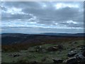
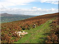
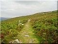
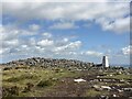
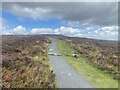
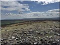
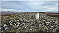
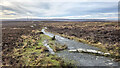
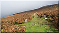
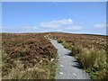
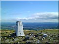
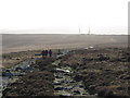
36 photos from this area
Area Information
Key information about the NP7 9NY including its size, population, and administrative classification.
- Area Type
- Postcode
- Area Size
- 3.9 km²
- Population
- 1606
- Population Density
- 57 people/km²
House Prices in NP7 9NY
38
Properties
£337,304
Average Sold Price
£99,950
Lowest Price
£650,000
Highest Price
Showing 38 properties
| Address | Type | Beds | Baths | Last Sale Price | Last Sale Date | |
|---|---|---|---|---|---|---|
| Llwyn Maen, Blaenavon Road, Govilon, NP7 9NY | Bungalow | 3 | 1 | £427,500 | Mar 2025 | |
| Rosedene, Blaenavon Road, Govilon, NP7 9NY | Detached | - | - | £650,000 | Oct 2022 | |
| The Bungalow, Blaenavon Road, Govilon, NP7 9NY | Bungalow | 3 | 3 | £330,000 | Feb 2021 | |
| Mountain Vista, Blaenavon Road, Govilon, NP7 9NY | Bungalow | 3 | 1 | £312,500 | Oct 2020 | |
| The Nestlings, Blaenavon Road, Govilon, NP7 9NY | Detached | - | - | £525,000 | Aug 2019 | |
| The Roost, Blaenavon Road, Govilon, NP7 9NY | house | - | - | £505,000 | Apr 2019 | |
| Kiln Lodge, Blaenavon Road, Govilon, NP7 9NY | Detached | 5 | 3 | £387,500 | Oct 2016 | |
| Gamlin Lodge, Blaenavon Road, Govilon, NP7 9NY | Detached | 4 | 1 | £365,000 | Oct 2016 | |
| Canal Wharf House, 0 Blaenavon Road, Govilon, Abergavenny, NP7 9NY | Detached | 4 | 2 | £300,000 | Dec 2015 | |
| Gatehouse, Blaenavon Road, Govilon, NP7 9NY | Detached | 2 | - | £140,000 | Oct 2015 |
Page 1 of 4
Energy Efficiency in NP7 9NY
Amenities
Schools
| Rank | School | Type | Entry gender | Ages |
|---|
Explore more schools in this area
Go to Schools tabDemographics
Household Size
Two person
most common
Accommodation Type
Houses
most common
Tenure
77
majority
Ethnic Group
White
most common
Religion
N/A
most common
Household Composition
N/A
most common
Age
47
median
Adults (30-64 years)
most common
Household Deprivation
N/A
with no deprivation
NS-SEC
43
in Lower managerial occupations
Explore more demographic insights in this area
Go to Demographics tabPlanning
Planning Constraints
- Flood RiskPremium
- Ramsar Wetland SitesPremium
- Area of Outstanding Natural BeautyPremium
- Protected Nature ReservePremium
- Protected WoodlandPremium
- Crime RiskPremium