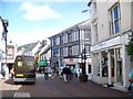
Area Overview for NP7 7DA
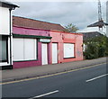
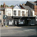
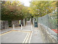
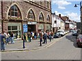
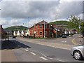
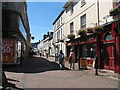
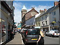
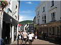
Photos of NP7 7DA


Area Information
The postcode NP7 7DA occupies a distinct residential cluster in Wales, covering an area of just 5.6 hectares. This compact footprint supports a population of 1,563 people, creating a tight-knit community where neighbours are likely to know one another. Living in NP7 7DA means navigating a high-density environment with a population density of 27,772 people per square kilometre. Such figures indicate a developed locality rather than sprawling hinterlands, where homes are situated close together. The area functions as a self-contained residential neighbourhood, defined by its specific boundaries and immediate surroundings. You will experience a community character shaped by these concentrated living arrangements. The small geographic size suggests limited internal green space within the postcode, making access to wider facilities a key aspect of daily life. Residents here share a common identity tied to this specific, well-defined location in the wider Abergavenny region. The area offers a straightforward, ground-level view of local life without the buffer of distant suburbs.
- Area Type
- Postcode
- Area Size
- 5.6 hectares
- Population
- Not available
- Population Density
- Not available
Homes in NP7 7DA are characterised by a specific housing stock profile driven by local ownership trends. With 47% of the population being homeowners, the area leans significantly towards owner-occupation compared to pure rental districts. This figure indicates that many residents have purchased property within this cluster rather than renting transiently. The predominant accommodation type is houses, which shapes the physical look of the neighbourhood compared to areas dominated by rental apartments. Prospective buyers should expect a market where ownership is widespread, often reflecting families who prioritise stability. The small size of the postcode, covering only 5.6 hectares, concentrates these houses into a dense residential pocket. This concentration means that finding specific larger properties might require searching further afield, as the immediate cluster is tightly packed. Understanding that nearly half the area is owner-occupied helps buyers gauge the long-term stability of the housing stock.
House Prices in NP7 7DA
Showing 38 properties
| Address | Type | Beds | Baths | Last Sale Price | Last Sale Date | |
|---|---|---|---|---|---|---|
| The Cedars, 27A Avenue Road, Abergavenny, NP7 7DA | house | - | - | £920,000 | Oct 2025 | |
| Pentlands, 24 Avenue Road, Abergavenny, NP7 7DA | house | - | - | £775,000 | Oct 2022 | |
| 12 Avenue Road, Abergavenny, NP7 7DA | house | - | - | £496,040 | Mar 2021 | |
| 21 Avenue Road, Abergavenny, NP7 7DA | house | - | - | £440,000 | Feb 2021 | |
| Hazeldene, 8 Avenue Road, Abergavenny, NP7 7DA | Semi-detached | 3 | 1 | £487,000 | Dec 2020 | |
| Grasmere, 10 Avenue Road, Abergavenny, NP7 7DA | house | - | - | £525,000 | Nov 2018 | |
| Moorlands, 23 Avenue Road, Abergavenny, NP7 7DA | Semi-detached | 3 | 1 | £365,000 | Sep 2017 | |
| Meadowcroft, 16 Avenue Road, Abergavenny, NP7 7DA | Semi-detached | 4 | - | £440,000 | Oct 2016 | |
| Tregarth, 25 Avenue Road, Abergavenny, NP7 7DA | house | - | - | £310,000 | Apr 2016 | |
| Langland, 17 Avenue Road, Abergavenny, NP7 7DA | Detached | 3 | - | £310,000 | Jul 2013 |
Energy Efficiency in NP7 7DA
Daily life for residents of NP7 7DA involves convenient access to essential retail and transport hubs. Your nearest shopping options include Tesco Abergavenny, Iceland Abergavenny, and Morrisons Abergavenny, all located within a practical distance. These five major retailers form a solid retail core, meaning you usually do not need to travel far for groceries or household necessities. Abergavenny Railway Station is also nearby, providing seamless rail connections for journeys beyond the immediate area. This combination of supermarkets and a railway station offers a balanced lifestyle with minimal travel time for daily tasks. You can manage weekly shopping runs and occasional commutes without spending hours in traffic. The convenience of these specific venues reinforces the area's character as a functional residential spot.
Amenities
Schools
Families considering NP7 7DA have access to several educational institutions within their reach. King Henry VIII Comprehensive School stands as a large, mixed sixth-form college option for older students. Cantref Primary serves younger children as a primary school within the same educational catchment logic. King Henry viii 3-19 School also operates in the vicinity, providing further education alongside the comprehensive option. Our Lady & St Michael’s School rounds out the list of nearby educational providers, acting as a supplementary or alternative institution for families. The presence of these specific schools, including King Henry VIII Comprehensive School and Cantref Primary, gives residents choice regarding their children's education. You can assess whether the primary or secondary options align with your needs before committing. The mix of named institutions implies that schooling is a considered part of daily life for households in this postcode.
| Rank | School | Type | Entry gender | Ages |
|---|
Explore more schools in this area
Go to Schools tabDemographics
The community within NP7 7DA reflects a mature demographic profile. The median age stands at 47 years, indicating that adults between the ages of 30 and 64 form the most common age range. This ageing population suggests a neighbourhood where established households dominate the social fabric. Home ownership levels stand at 47%, meaning that almost half of the residents own their property outright or with a mortgage. The remaining households include renters or those waiting to move into the market. Accommodation in this area consists primarily of houses, offering traditional living spaces rather than high-rise flats. The vast majority of the population identifies as White, reflecting the cultural background of most families residing here. These statistics paint a picture of a stable, established community where many people have put down roots over time. Living in NP7 7DA involves engaging with a demographic that values stability and family life.
Household Size
Accommodation Type
Tenure
Ethnic Group
Religion
Household Composition
Age
Household Deprivation
NS-SEC
Explore more demographic insights in this area
Go to Demographics tabPlanning
Planning Constraints
- Flood RiskPremium
- Ramsar Wetland SitesPremium
- Area of Outstanding Natural BeautyPremium
- Protected Nature ReservePremium
- Protected WoodlandPremium
- Crime RiskPremium