Area Overview for NP7 6NY
Photos of NP7 6NY
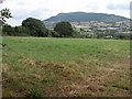

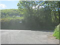


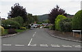
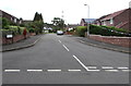
55 photos from this area
Area Information
Key information about the NP7 6NY including its size, population, and administrative classification.
- Area Type
- Postcode
- Area Size
- 18.5 hectares
- Population
- 1498
- Population Density
- 82 people/km²
House Prices in NP7 6NY
7
Properties
£600,000
Average Sold Price
£600,000
Lowest Price
£600,000
Highest Price
Showing 7 properties
| Address | Type | Beds | Baths | Last Sale Price | Last Sale Date | |
|---|---|---|---|---|---|---|
| Plas Y Ffynnon, Great House Lane, Triley, Llantilio Pertholey, NP7 6NY | Detached | 4 | 2 | £600,000 | Aug 2015 | |
| Pentwyn House, Ty Gwyn Hall, Great House Lane, Triley, Llantilio Pertholey, NP7 6NY | hospital_care_home | - | - | - | - | |
| Skirrid View, Ty Gwyn Hall Nursing Home, Great House Lane, Triley, Llantilio Pertholey, NP7 6NY | commercial | - | - | - | - | |
| St Teilo House, Ty Gwyn Road, Llantilio Pertholey, NP7 6NY | Detached | - | - | - | - | |
| Deri Farm Bungalow, Ty Gwyn Road, Llantilio Pertholey, NP7 6NY | Bungalow | - | - | - | - | |
| Craegmoor Healthcare, Ty Gwyn Hall Nursing Home, Great House Lane, Triley, Llantilio Pertholey, NP7 6NY | commercial | - | - | - | - | |
| Oaklea, Ty Gwyn Road, Llantilio Pertholey, NP7 6NY | Detached | - | - | - | - |
Energy Efficiency in NP7 6NY
Amenities
Schools
| Rank | School | Type | Entry gender | Ages |
|---|
Explore more schools in this area
Go to Schools tabDemographics
Household Size
Two person
most common
Accommodation Type
Houses
most common
Tenure
82
majority
Ethnic Group
White
most common
Religion
N/A
most common
Household Composition
N/A
most common
Age
47
median
Adults (30-64 years)
most common
Household Deprivation
N/A
with no deprivation
NS-SEC
39
in Lower managerial occupations
Explore more demographic insights in this area
Go to Demographics tabPlanning
Planning Constraints
- Flood RiskPremium
- Ramsar Wetland SitesPremium
- Area of Outstanding Natural BeautyPremium
- Protected Nature ReservePremium
- Protected WoodlandPremium
- Crime RiskPremium