Area Overview for NP7 6EL
Photos of NP7 6EL


Area Information
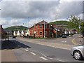
Living in NP7 6EL offers a compact residential experience within a small cluster covering just 3.4 hectares. You are part of a tightly knit community where 1,563 residents call this postcode their home. The population density of 46,396 people per square kilometre creates an intimate neighbourhood feel, removing the anonymity of larger urban sprawls. This specific area sits in Wales, distinct from the English property market while sharing similar regional characteristics. Daily life here is defined by proximity, as every household is moments away from local services and neighbours alike. You do not need to drive far to access your garden or local shop, making the most of your time. The high density means streets are well-used by pedestrians, fostering a sense of community that larger developments often lack. For those seeking a defined postcode to lock onto, this location provides clear boundaries. You will know exactly where your property sits within the wider settlement. The small footprint ensures a quiet environment, yet you remain connected to broader amenities without needing a car for every outing. This balance of seclusion and accessibility defines the character of homes in this specific sector.
- Area Type
- Postcode
- Area Size
- 3.4 hectares
- Population
- Not available
- Population Density
- Not available
The property market in NP7 6EL is characterised by its focus on traditional housing. Houses constitute the main accommodation type, so you will primarily encounter detached, semi-detached, and terraced family homes. Only 47 per cent of residents own their homes, meaning a significant portion of the market consists of rented properties or homes being sold by investors. This split creates a dynamic environment where both buyers and landlords operate actively within the postcode. The small area size of 3.4 hectares limits supply, which often drives prices steady or upward depending on demand from surrounding regions. You will find that homes in this area suit those seeking permanence and privacy. The high population density of over 46,000 people per square kilometre ensures that buyers have access to a variety of layouts within a short distance. Unlike sprawling suburbs with vast tracts of undeveloped land, this market is compact and efficient. Potential buyers should note that the 47 per cent ownership rate means competition for owner-occupied stock can be keen. Conversely, those looking for rental investment opportunities will find a solid foundation here. The mix of tenure provides flexibility for different types of investors and residents alike.
House Prices in NP7 6EL
Showing 61 properties
| Address | Type | Beds | Baths | Last Sale Price | Last Sale Date | |
|---|---|---|---|---|---|---|
| 12 Old Hereford Road, Abergavenny, NP7 6EL | Semi-detached | 3 | 2 | £245,000 | Aug 2025 | |
| 15 Old Hereford Road, Abergavenny, NP7 6EL | house | - | - | £265,000 | Dec 2022 | |
| 10 Old Hereford Road, Abergavenny, NP7 6EL | house | - | - | £232,000 | Sep 2021 | |
| 8 Old Hereford Road, Abergavenny, NP7 6EL | Flat | - | - | £60,000 | May 2012 | |
| 4, Holm Oak Court, Old Hereford Road, Abergavenny, NP7 6EL | Flat | - | - | £132,000 | Feb 2009 | |
| 13 Old Hereford Road, Abergavenny, NP7 6EL | Semi-detached | - | - | £115,000 | Nov 2008 | |
| 1 Old Hereford Road, Abergavenny, NP7 6EL | Flat | - | - | - | - | |
| 3, Holm Oak Court, Old Hereford Road, Abergavenny, NP7 6EL | Flat | 2 | - | - | - | |
| 1, Holm Oak Court, Old Hereford Road, Abergavenny, NP7 6EL | Flat | - | - | - | - | |
| 2, Holm Oak Court, Old Hereford Road, Abergavenny, NP7 6EL | Flat | - | - | - | - |
Energy Efficiency in NP7 6EL
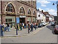
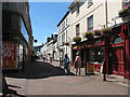
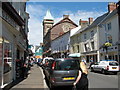
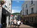
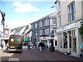
Your lifestyle in NP7 6EL is supported by practical amenities within easy reach. Supermarkets include Iceland Abergavenny, Tesco Abergavenny, and Morrisons Abergavenny, ensuring you have a wide choice for groceries and household goods. Your travel needs are met by Abergavenny Railway Station, located just one stop away. You can commute to Cardiff, London, or other cities with a single change. This station link is vital for anyone who does not drive regularly or wants to keep traffic free. The five major retail outlets in the immediate vicinity mean you rarely need to venture far for essentials. Dining options and daily errands are covered under the retail umbrella of Abergavenny's high street. You will find that the combination of rail access and supermarket provision creates a convenient urban feel within a residential setting. Residents enjoy the benefits of a town centre located at the doorstep. Convenience is a defining feature of life here, as Abergavenny serves as the hub for all local commerce.
Amenities
Schools
Families living in NP7 6EL have access to a range of educational institutions nearby. Your options include King Henry VIII Comprehensive School, which caters to older students, and King Henry viii 3-19 School, offering extended education pathways. For younger children, Cantref Primary provides early years and primary education. Your list also includes Our Lady & St Michael's School for older primary or secondary needs. These schools fall under the general category of other institutions, reflecting their specific governance or structure within the Welsh education system. The presence of both comprehensive and specialist 3-19 schools suggests a robust educational infrastructure serving the age profile of the area. You do not have to commit to a single catchment zone for every stage of your child's life. The mix of school types allows you to choose based on pedagogical approach or league table performance. Having Cantref Primary so close means short commutes for parents with young children. King Henry VIII Comprehensive School offers continuity for students transitioning into adulthood. The proximity of these venues enhances the quality of life for families considering homes in this specific postcode.
| Rank | School | Type | Entry gender | Ages |
|---|
Explore more schools in this area
Go to Schools tabDemographics
The community in NP7 6EL is defined by a mature population profile. The median age stands at 47 years, indicating that Adults aged 30 to 64 years make up the most common age range. This demographic suggests a neighbourhood dominated by established professionals and families rather than young singles or retirees. Home ownership levels sit at 47 per cent, a figure that reflects a mixed tenure landscape. Almost half of the households own their properties outright, while the other half remain in the rental market or through shared ownership schemes. The predominant ethnic group is White, which is the standard for many parts of South Wales. Houses remain the primary accommodation type, meaning you will find detached and semi-detached properties rather than high-rise flats or terraced blocks. This housing style aligns with the family-oriented age profile. You are not likely to encounter the student housing blocks common near universities, nor the retirement complexes found in some coastal towns. The stable population and steady home ownership rate suggest a community focused on long-term residency. This stability creates a predictable environment for new buyers looking to settle down in this Welsh location.
Household Size
Accommodation Type
Tenure
Ethnic Group
Religion
Household Composition
Age
Household Deprivation
NS-SEC
Explore more demographic insights in this area
Go to Demographics tabPlanning
Planning Constraints
- Flood RiskPremium
- Ramsar Wetland SitesPremium
- Area of Outstanding Natural BeautyPremium
- Protected Nature ReservePremium
- Protected WoodlandPremium
- Crime RiskPremium