Area Overview for NP7 5PP
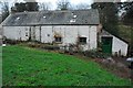
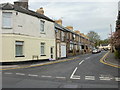
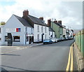
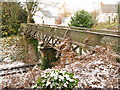
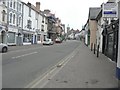
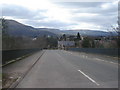
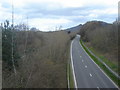
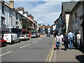
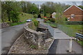
Photos of NP7 5PP


Area Information
Living in NP7 5PP means residing within a specific postcode area covering a small residential cluster of just 2783 square metres. This limited footprint defines a tightly knit locality rather than a sprawling neighbourhood. You will find a population of 1750 people calling this space home, creating an environment where neighbours are likely to know one another. The area is situated in Wales, offering a distinct location within the broader Welsh landscape. Daily life here revolves around proximity and established routines as residents make the most of their immediate surroundings. The compact size means you can walk to many destinations or rely on local transport links familiar to the community. This postcode serves as the address for a specific group of households rather than a large district. The setting provides a defined sense of place without the anonymity of a larger urban zone. You are stepping into a real community with a clear history and a stable resident base. The small scale ensures that services and amenities operate at a manageable distance from your front door. This area remains a concrete part of the local map with clear boundaries and a fixed population count.
- Area Type
- Postcode
- Area Size
- 2783 m²
- Population
- 1750
- Population Density
- 3411 people/km²
The property market in NP7 5PP is defined by a high rate of residence 68 per cent of households own their homes. This figure suggests a community focused on stability and long-term living rather than short-term tenancies. The accommodation type is dominated by houses, meaning you will not find modern flats or high-rise apartments in this cluster. Buyers considering homes in NP7 5PP should expect to look at traditional property styles typical of the Welsh housing stock. With only 2783 square metres covering the postcode area, the number of available homes is naturally limited compared to larger districts. This scarcity creates a niche market where specific properties carry significant value to local residents. The low population count of 1750 reinforces the idea that this is a small, intimate housing cluster rather than a broad development zone. You will likely find a market where prices reflect the exclusivity of the location and the quality of the immediate surroundings. The high ownership rate means that many listings will come from owners wishing to upsize or move, rather than landlords seeking returns. Buying here offers the chance to join an established community with strong roots and clear property boundaries.
House Prices in NP7 5PP
Showing 6 properties
| Address | Type | Beds | Baths | Last Sale Price | Last Sale Date | |
|---|---|---|---|---|---|---|
| Flat 2, Priory Court, 4 Hereford Road, Abergavenny, NP7 5PP | Flat | - | - | - | - | |
| Flat 6, Priory Court, 4 Hereford Road, Abergavenny, NP7 5PP | Flat | - | - | - | - | |
| Flat 5, Priory Court, 4 Hereford Road, Abergavenny, NP7 5PP | Flat | - | - | - | - | |
| Flat 3, Priory Court, 4 Hereford Road, Abergavenny, NP7 5PP | Flat | - | - | - | - | |
| Flat 4, Priory Court, 4 Hereford Road, Abergavenny, NP7 5PP | Flat | - | - | - | - | |
| Flat 1, Priory Court, 4 Hereford Road, Abergavenny, NP7 5PP | Flat | - | - | - | - |
Energy Efficiency in NP7 5PP
Local lifestyle in NP7 5PP revolves around a few key amenities within practical reach. Residents have access to five nearby retail locations, including Morrisons Abergavenny, Morrisons Daily, and Iceland Abergavenny. These supermarkets provide a solid range of essentials for grocery shopping and household needs. Abergavenny Railway Station offers rail access for those who commute or travel to other parts of the region. For most of the population of 1750 people, this combination of retail and rail provides a comprehensive suite of options daily life. The retail cluster reduces the need for long car journeys for weekly shopping runs. You can combine errands into efficient trips that save time and fuel. The presence of multiple grocery chains indicates a well-supported local economy capable of serving the household. With 68 per cent home ownership, the area holds together as a traditional community relying on established local services. The amenities listed are the primary external connections for the village centre. This setup ensures that life here remains convenient without requiring extensive travel for basic necessities.
Amenities
Schools
| Rank | School | Type | Entry gender | Ages |
|---|
Explore more schools in this area
Go to Schools tabDemographics
The community in NP7 5PP reflects an established settlement with a median age of 47 years. Most residents fall into the adult age range of 30 to 64 years, indicating a mature demographic profile. Homeownership stands at 68 per cent, showing that two out of three households own their property outright or with a mortgage. This high level of ownership contributes to a stable residential environment where residents have long-term stakes in the locality. The predominant ethnic group is White, which shapes the cultural character of the neighbourhood. Housing stock consists primarily of houses, offering traditional forms of accommodation suited to family life and established households. There is minimal data provided on deprivation levels, so the community appears to function without significant reported socioeconomic challenges. The population density figure reflects a concentrated living pattern within the available land. You will encounter a neighbourhood where families and older adults mix in shared local spaces. The demographic data paints a picture of a settled area where stability is the norm rather than the exception.
Household Size
Accommodation Type
Tenure
Ethnic Group
Religion
Household Composition
Age
Household Deprivation
NS-SEC
Explore more demographic insights in this area
Go to Demographics tabPlanning
Planning Constraints
- Flood RiskPremium
- Ramsar Wetland SitesPremium
- Area of Outstanding Natural BeautyPremium
- Protected Nature ReservePremium
- Protected WoodlandPremium
- Crime RiskPremium