Area Overview for NP6 5UR
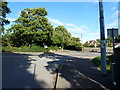
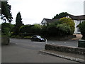
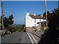
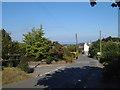
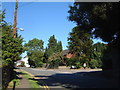
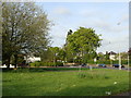
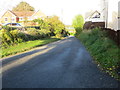
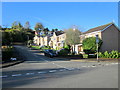
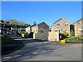
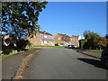
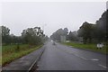
Photos of NP6 5UR

Area Information
NP6 5UR is a specific residential cluster located in Wales, comprising a small population of around 1878 people. This postcode cluster offers a compact community setting where residents enjoy a straightforward local environment. Because the area contains 1878 individuals, the built-up footprint remains relatively contained, fostering a quieter atmosphere compared to larger urban settlements. The location serves as a practical base for those seeking a stable home environment within the boundaries of this defined cluster. Daily life here revolves around the immediate neighbourhood rather than sprawling into distant developments. The sheer size of the area, defined by its postcode, means that services are centralised within easy reach of each household. Residents find that their daily movements do not require extensive travel, supporting a lifestyle grounded in local convenience. The area functions as a distinct residential unit within the wider Welsh landscape, providing a specific address for homes in this postcode area. You will find that the neighbourhood maintains a consistent character, typical of a small, self-contained residential block in Wales. The compact nature of NP6 5UR ensures that you are never truly far from your local surroundings, which enhances the sense of place.
- Area Type
- Postcode
- Area Size
- Not available
- Population
- 1878
- Population Density
- 2273 people/km²
The housing market in NP6 5UR is characterised entirely by house ownership, as all accommodation in this area consists of houses. You will not encounter flats or apartment blocks when searching for homes in this specific postcode. Nearly half of the population, standing at exactly 49%, are home owners, suggesting that this is a region where purchase and equity building are common. This ownership rate contrasts with areas dominated by the private rental sector, making NP6 5UR a stable environment for buyers looking to settle down. The fact that the local stock is exclusively houses implies a setting suitable for families, empty nesters, or professionals seeking a traditional home environment. When you look at homes in NP6 5UR, you are examining properties designed for ground-level living and garden space rather than shared elevator blocks. This consistency in accommodation type means buyers face a predictable housing stock without the need to consider mixed-use developments. The area functions primarily as a residential zone where property values track with the local supply of standalone dwellings. You should expect a market focused on residential rather than investment flats if you are searching within this concise boundary.
House Prices in NP6 5UR
No properties found in this postcode.
Energy Efficiency in NP6 5UR
Residents of NP6 5UR benefit from a compact range of amenities that are within practical reach of their homes. For everyday shopping needs, you can visit M&S Chepstow, Spar, or Tesco Chepstow. These retail outlets provide a full selection of groceries, household essentials, and clothing without the need for extensive travelling. The area also offers excellent rail connectivity, with four stations located nearby. Chepstow Railway Station, Caldicot Railway Station, and Severn Tunnel Junction Railway Station provide options for commuting or leisure travel. Being able to access these rail hubs means that you are well-positioned to travel to London or other major cities efficiently. The presence of these stations alongside local retail stores creates a balanced lifestyle where daily errands and regional trips are equally accessible. You do not need to drive far to find a supermarket or board a train. The convenience of having Spar and Tesco nearby ensures that your household shopping is straightforward. These amenities, combined with the four nearby train stations, define the lifestyle in NP6 5UR. The area provides a self-sufficient environment where residents rarely need to look far to meet their daily needs.
Amenities
Schools
Families living in NP6 5UR have access to several educational institutions, though the nearest options lie just outside the immediate residential cluster. The Dell Primary School serves as a key local facility, offering education to younger children in the surrounding community. Chepstow School also operates nearby, providing secondary education options for older students. Both schools fall under the "other" category, which indicates they do not carry specific Ofsted ratings within the provided data. Consequently, you cannot cite a formal rating of good or outstanding for these venues based on the information available. The presence of a primary school and a secondary school suggests that the area is integrated into a broader educational landscape centred on Chepstown. Parents must look beyond the immediate postcode to find these facilities, as no schools are listed as being within the NP6 5UR cluster itself. This geographic arrangement means that daily routes to school likely involve travel to the main town. The mix of primary and secondary provision allows for a comprehensive local education system without requiring students to commute to distant towns. When planning for your children, check travel routines to The Dell Primary School and Chepstow School carefully.
| Rank | School | Type | Entry gender | Ages |
|---|
Explore more schools in this area
Go to Schools tabDemographics
The community in NP6 5UR is defined by a mature demographic profile, with a median age of 47 years. Adults aged between 30 and 64 years represent the most common age range within this postcode cluster. This age distribution suggests a population with significant life experience and established household structures. Home ownership stands at 49%, indicating a balanced market where nearly half of the residents own their homes outright. The remaining households are likely tenants or those in the process of purchasing property. All accommodation in this area consists of houses, meaning you will not find flats or high-rise blocks within this specific postcode. The predominant ethnic group is White, reflecting the demographic makeup typical of the broader region. Children under the age of 30 are less common here, which aligns with the older median age. The absence of younger families and the presence of adult homeowners create a neighbourhood where stability is the primary characteristic. These figures paint a picture of a settled community where property is a long-term commitment and the resident base remains relatively constant over time.
Household Size
Accommodation Type
Tenure
Ethnic Group
Religion
Household Composition
Age
Household Deprivation
NS-SEC
Explore more demographic insights in this area
Go to Demographics tabPlanning
Planning Constraints
- Flood RiskPremium
- Ramsar Wetland SitesPremium
- Area of Outstanding Natural BeautyPremium
- Protected Nature ReservePremium
- Protected WoodlandPremium
- Crime RiskPremium