Area Overview for NP25 5AH
Photos of NP25 5AH
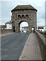
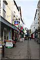
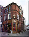
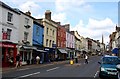


100 photos from this area
Area Information
Key information about the NP25 5AH including its size, population, and administrative classification.
- Area Type
- Postcode
- Area Size
- 1.6 hectares
- Population
- 1073
- Population Density
- 5061 people/km²
House Prices in NP25 5AH
26
Properties
£183,995
Average Sold Price
£60,000
Lowest Price
£315,000
Highest Price
Showing 26 properties
| Address | Type | Beds | Baths | Last Sale Price | Last Sale Date | |
|---|---|---|---|---|---|---|
| 29 Wonastow Road, Monmouth, NP25 5AH | Semi-detached | 3 | 1 | £255,000 | Sep 2025 | |
| 33 Wonastow Road, Monmouth, NP25 5AH | Semi-detached | 4 | 1 | £270,000 | Oct 2023 | |
| 27 Wonastow Road, Monmouth, NP25 5AH | Bungalow | - | - | £155,000 | Jul 2019 | |
| 21 Wonastow Road, Monmouth, NP25 5AH | Bungalow | - | - | £285,000 | Sep 2017 | |
| 17 Wonastow Road, Monmouth, NP25 5AH | Bungalow | - | - | £162,000 | Sep 2016 | |
| 23 Wonastow Road, Monmouth, NP25 5AH | Bungalow | 3 | - | £177,000 | Jul 2016 | |
| 4 Wonastow Road, Monmouth, NP25 5AH | Detached | 5 | 5 | £315,000 | Dec 2015 | |
| 25 Wonastow Road, Monmouth, NP25 5AH | Semi-detached | - | - | £94,950 | Jun 2002 | |
| 13 Wonastow Road, Monmouth, NP25 5AH | Semi-detached | 3 | 1 | £60,000 | Oct 1997 | |
| 11 Wonastow Road, Monmouth, NP25 5AH | Semi-detached | 3 | 1 | £66,000 | Aug 1996 |
Page 1 of 3
Energy Efficiency in NP25 5AH
Amenities
Schools
| Rank | School | Type | Entry gender | Ages |
|---|
Explore more schools in this area
Go to Schools tabDemographics
Household Size
One person
most common
Accommodation Type
Houses
most common
Tenure
64
majority
Ethnic Group
White
most common
Religion
N/A
most common
Household Composition
N/A
most common
Age
47
median
Adults (30-64 years)
most common
Household Deprivation
N/A
with no deprivation
NS-SEC
29
in Lower managerial occupations
Explore more demographic insights in this area
Go to Demographics tabPlanning
Planning Constraints
- Flood RiskPremium
- Ramsar Wetland SitesPremium
- Area of Outstanding Natural BeautyPremium
- Protected Nature ReservePremium
- Protected WoodlandPremium
- Crime RiskPremium