Area Overview for NP25 4QD
Photos of NP25 4QD
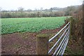
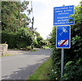
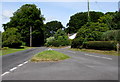
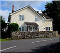
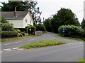
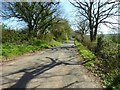
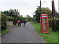
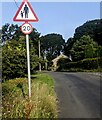
28 photos from this area
Area Information
Key information about the NP25 4QD including its size, population, and administrative classification.
- Area Type
- Postcode
- Area Size
- 19.5 hectares
- Population
- 1405
- Population Density
- 55 people/km²
House Prices in NP25 4QD
11
Properties
£386,786
Average Sold Price
£100,000
Lowest Price
£700,000
Highest Price
Showing 11 properties
| Address | Type | Beds | Baths | Last Sale Price | Last Sale Date | |
|---|---|---|---|---|---|---|
| Min Yr Awel, Tintern Road, Parkhouse, Trellech, NP25 4QD | Detached | 4 | 3 | £532,500 | Nov 2023 | |
| New Orchard, Tintern Road, Parkhouse, Trellech, NP25 4QD | Bungalow | 3 | 1 | £412,500 | Nov 2022 | |
| Hill Cottage, Tintern Road, Parkhouse, Trellech, NP25 4QD | Detached | 4 | 2 | £355,000 | May 2016 | |
| Hillcrest, Tintern Road, Parkhouse, Trellech, NP25 4QD | Detached | 4 | 3 | £362,500 | Nov 2015 | |
| Wells Farm House, Park House Road, Parkhouse, Trellech, NP25 4QD | Detached | - | - | £700,000 | Nov 2006 | |
| Wentwood, Tintern Road, Parkhouse, Trellech, NP25 4QD | Detached | - | - | £245,000 | Mar 2000 | |
| Hope Cottage, Park House Road, Parkhouse, Trellech, NP25 4QD | Detached | - | - | £100,000 | Feb 1999 | |
| Laneside, Tintern Road, Parkhouse, Trellech, NP25 4QD | Retail | 5 | 3 | - | - | |
| Highfield, Park House Road, Parkhouse, Trellech, NP25 4QD | Detached | - | - | - | - | |
| Little Orchard, Tintern Road, Parkhouse, Trellech, NP25 4QD | house | 3 | - | - | - |
Page 1 of 2
Energy Efficiency in NP25 4QD
Amenities
Schools
| Rank | School | Type | Entry gender | Ages |
|---|
Explore more schools in this area
Go to Schools tabDemographics
Household Size
Two person
most common
Accommodation Type
Houses
most common
Tenure
80
majority
Ethnic Group
White
most common
Religion
N/A
most common
Household Composition
N/A
most common
Age
47
median
Adults (30-64 years)
most common
Household Deprivation
N/A
with no deprivation
NS-SEC
46
in Lower managerial occupations
Explore more demographic insights in this area
Go to Demographics tabPlanning
Planning Constraints
- Flood RiskPremium
- Ramsar Wetland SitesPremium
- Protected Nature ReservePremium
- Protected WoodlandPremium
- Crime RiskPremium