Area Overview for NP25 4PQ
Photos of NP25 4PQ
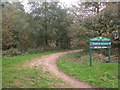
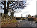
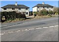
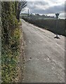
17 photos from this area
Area Information
Key information about the NP25 4PQ including its size, population, and administrative classification.
- Area Type
- Postcode
- Area Size
- 1.7 km²
- Population
- 1405
- Population Density
- 55 people/km²
House Prices in NP25 4PQ
18
Properties
£603,667
Average Sold Price
£45,000
Lowest Price
£1,500,000
Highest Price
Showing 18 properties
| Address | Type | Beds | Baths | Last Sale Price | Last Sale Date | |
|---|---|---|---|---|---|---|
| The Observatory, 0 , Trelleck, Monmouth, NP25 4PQ | Bungalow | 5 | 4 | £667,000 | Nov 2022 | |
| Hillside Grange, Warrens Road, Trellech, NP25 4PQ | house | 6 | 5 | £1,500,000 | Jun 2021 | |
| The Firs, Warrens Road, Trellech, NP25 4PQ | Bungalow | - | - | £45,000 | Nov 2018 | |
| Warren Fields Cottage, Monmouth Road, Trellech, NP25 4PQ | house | - | - | £985,000 | Mar 2017 | |
| Greenway Cottage, Greenway Lane, Trellech, NP25 4PQ | Cottage | 3 | 2 | £260,000 | Jul 2008 | |
| Warren Fields Farm, Monmouth Road, Trellech, NP25 4PQ | Bungalow | 5 | - | £165,000 | Jun 1997 | |
| Trelleck Barn, Greenway Lane, Trellech, NP25 4PQ | Land | 1 | 1 | - | - | |
| Upper Barn, Beacon Road, Trellech, NP25 4PQ | Detached | - | - | - | - | |
| Caravan, Penlan Cottage, Greenway Lane, Trellech, NP25 4PQ | Mobile Home | - | - | - | - | |
| Green Barn, Greenway Lane, Trellech, NP25 4PQ | Office | - | - | - | - |
Page 1 of 2
Energy Efficiency in NP25 4PQ
Amenities
Schools
| Rank | School | Type | Entry gender | Ages |
|---|
Explore more schools in this area
Go to Schools tabDemographics
Household Size
Two person
most common
Accommodation Type
Houses
most common
Tenure
80
majority
Ethnic Group
White
most common
Religion
N/A
most common
Household Composition
N/A
most common
Age
47
median
Adults (30-64 years)
most common
Household Deprivation
N/A
with no deprivation
NS-SEC
46
in Lower managerial occupations
Explore more demographic insights in this area
Go to Demographics tabPlanning
Planning Constraints
- Flood RiskPremium
- Ramsar Wetland SitesPremium
- Protected Nature ReservePremium
- Protected WoodlandPremium
- Crime RiskPremium