Area Overview for NP25 4JG
Photos of NP25 4JG

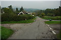


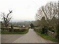
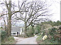
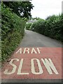


13 photos from this area
Area Information
Key information about the NP25 4JG including its size, population, and administrative classification.
- Area Type
- Postcode
- Area Size
- 52.7 hectares
- Population
- 1237
- Population Density
- 28 people/km²
House Prices in NP25 4JG
28
Properties
£505,994
Average Sold Price
£102,000
Lowest Price
£900,000
Highest Price
Showing 28 properties
| Address | Type | Beds | Baths | Last Sale Price | Last Sale Date | |
|---|---|---|---|---|---|---|
| The Fencing Post, Mitchel Troy Common Road, Mitchel Troy, NP25 4JG | Bungalow | 3 | 1 | £612,500 | Apr 2025 | |
| Brynmawr Lodge, Mitchel Troy Common Road, Mitchel Troy, NP25 4JG | Detached | 4 | 2 | £810,000 | Mar 2025 | |
| Brookmead, Mitchel Troy Common Road, Mitchel Troy, NP25 4JG | house | 5 | - | £815,000 | Oct 2023 | |
| Brynhyfryd, Mitchel Troy Common Road, Mitchel Troy, NP25 4JG | house | - | - | £725,000 | Dec 2021 | |
| Ivy Cottage, Mitchel Troy Common Road, Mitchel Troy, NP25 4JG | Detached | 4 | 2 | £545,000 | Nov 2018 | |
| Spring Cottage, Village Road, Mitchel Troy Common, Mitchel Troy, NP25 4JG | Detached | 4 | 1 | £333,000 | Jan 2018 | |
| Stonehouse, Common Road, Mitchel Troy, NP25 4JG | Detached | 5 | 4 | £900,000 | Feb 2017 | |
| Ty Newydd, Common Road, Mitchel Troy, NP25 4JG | Detached | 4 | - | £309,950 | Aug 2014 | |
| The Old Post Office, Mitchel Troy Common Road, Mitchel Troy, NP25 4JG | Detached | - | - | £395,000 | Nov 2006 | |
| Dower House, Mitchel Troy Common Road, Mitchel Troy, NP25 4JG | house | - | - | £374,475 | Nov 2003 |
Page 1 of 3
Energy Efficiency in NP25 4JG
Amenities
Schools
| Rank | School | Type | Entry gender | Ages |
|---|
Explore more schools in this area
Go to Schools tabDemographics
Household Size
Two person
most common
Accommodation Type
Houses
most common
Tenure
78
majority
Ethnic Group
White
most common
Religion
N/A
most common
Household Composition
N/A
most common
Age
47
median
Adults (30-64 years)
most common
Household Deprivation
N/A
with no deprivation
NS-SEC
40
in Lower managerial occupations
Explore more demographic insights in this area
Go to Demographics tabPlanning
Planning Constraints
- Flood RiskPremium
- Ramsar Wetland SitesPremium
- Protected Nature ReservePremium
- Protected WoodlandPremium
- Crime RiskPremium