Area Overview for NP16 6SF
Photos of NP16 6SF
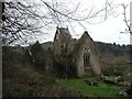
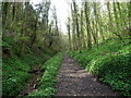
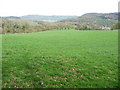
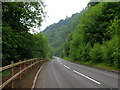
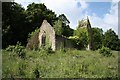

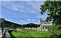
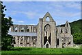

100 photos from this area
Area Information
Key information about the NP16 6SF including its size, population, and administrative classification.
- Area Type
- Postcode
- Area Size
- 89.8 hectares
- Population
- 1515
- Population Density
- 51 people/km²
House Prices in NP16 6SF
19
Properties
£335,000
Average Sold Price
£175,000
Lowest Price
£415,000
Highest Price
Showing 19 properties
| Address | Type | Beds | Baths | Last Sale Price | Last Sale Date | |
|---|---|---|---|---|---|---|
| Monkstone, Chapel Hill Road, Tintern, NP16 6SF | Bungalow | 3 | 2 | £375,000 | Apr 2019 | |
| Monks Orchard, Chapel Hill Road, Tintern, NP16 6SF | Detached | 4 | 3 | £415,000 | Mar 2016 | |
| St Tewdric, Chapel Hill Road, Tintern, NP16 6SF | Detached | 5 | - | £375,000 | Mar 2014 | |
| Hillcrest, Hillcrest Lane, Tintern, NP16 6SF | house | 3 | - | £175,000 | Aug 2010 | |
| Abbey View, Chapel Hill Road, Tintern, NP16 6SF | Semi-detached | - | - | - | - | |
| Abbey Cottage, A 466 Tintern To St Arvans, Tintern, NP16 6SF | house | - | - | - | - | |
| Reddings Farm, Glynwood Lane, Chapel Hill, Tintern, NP16 6SF | Farm | - | - | - | - | |
| Flat At, The Abbey Hotel, A 466 Tintern To St Arvans, Tintern, NP16 6SF | Flat | - | - | - | - | |
| The Coach House, Chapel Hill Road, Tintern, NP16 6SF | Detached | - | - | - | - | |
| Tintafia Pc Repair, Abbey Lodge, Chapel Hill Road, Tintern, NP16 6SF | Office | - | - | - | - |
Page 1 of 2
Energy Efficiency in NP16 6SF
Amenities
Schools
| Rank | School | Type | Entry gender | Ages |
|---|
Explore more schools in this area
Go to Schools tabDemographics
Household Size
Two person
most common
Accommodation Type
Houses
most common
Tenure
81
majority
Ethnic Group
White
most common
Religion
N/A
most common
Household Composition
N/A
most common
Age
47
median
Adults (30-64 years)
most common
Household Deprivation
N/A
with no deprivation
NS-SEC
51
in Lower managerial occupations
Explore more demographic insights in this area
Go to Demographics tabPlanning
Planning Constraints
- Flood RiskPremium
- Ramsar Wetland SitesPremium
- Protected Nature ReservePremium
- Protected WoodlandPremium
- Crime RiskPremium