Area Overview for NP16 6QG
Photos of NP16 6QG
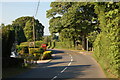
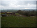
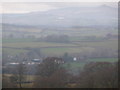
22 photos from this area
Area Information
Key information about the NP16 6QG including its size, population, and administrative classification.
- Area Type
- Postcode
- Area Size
- 45.3 hectares
- Population
- 1405
- Population Density
- 55 people/km²
House Prices in NP16 6QG
17
Properties
£291,988
Average Sold Price
£88,000
Lowest Price
£590,000
Highest Price
Showing 17 properties
| Address | Type | Beds | Baths | Last Sale Price | Last Sale Date | |
|---|---|---|---|---|---|---|
| Brockhurst, Parsonage Road, Llanishen, NP16 6QG | Bungalow | - | - | £230,000 | Jan 2012 | |
| Hill Place, Llanishen Hill Road, Llanishen, NP16 6QG | Detached | - | - | £590,000 | Nov 2006 | |
| Trewyn, Greenlands Link, Llanishen, NP16 6QG | house | - | - | £259,950 | Nov 2002 | |
| Cartref, B 4293 Quarry Road To Cross Lane, Llanishen, NP16 6QG | Terraced | - | - | £88,000 | May 1997 | |
| THE MEWS HOUSE, PARSONAGE ROAD, Llanishen, NP16 6QG | Flat | 3 | 1 | - | - | |
| Caravan At, Pond Barn, Quarry Road, Llanishen, NP16 6QG | Mobile Home | - | - | - | - | |
| Woodside, Quarry Road, Llanishen, NP16 6QG | Detached | - | - | - | - | |
| Penybryn, Quarry Road, Llanishen, NP16 6QG | Detached | - | - | - | - | |
| Gable Cottage, Llanishen Hill Road, Llanishen, NP16 6QG | Detached | - | - | - | - | |
| Homestead, B 4293 Quarry Road To Cross Lane, Llanishen, NP16 6QG | Detached | - | - | - | - |
Page 1 of 2
Energy Efficiency in NP16 6QG
Amenities
Schools
| Rank | School | Type | Entry gender | Ages |
|---|
Explore more schools in this area
Go to Schools tabDemographics
Household Size
Two person
most common
Accommodation Type
Houses
most common
Tenure
80
majority
Ethnic Group
White
most common
Religion
N/A
most common
Household Composition
N/A
most common
Age
47
median
Adults (30-64 years)
most common
Household Deprivation
N/A
with no deprivation
NS-SEC
46
in Lower managerial occupations
Explore more demographic insights in this area
Go to Demographics tabPlanning
Planning Constraints
- Flood RiskPremium
- Ramsar Wetland SitesPremium
- Protected Nature ReservePremium
- Protected WoodlandPremium
- Crime RiskPremium