Area Overview for NP16 6NJ
Photos of NP16 6NJ
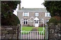
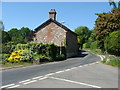
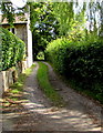
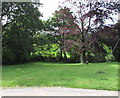
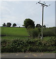
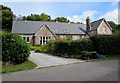
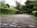
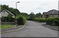
50 photos from this area
Area Information
Key information about the NP16 6NJ including its size, population, and administrative classification.
- Area Type
- Postcode
- Area Size
- 47.2 hectares
- Population
- 1405
- Population Density
- 55 people/km²
House Prices in NP16 6NJ
20
Properties
£434,013
Average Sold Price
£339,100
Lowest Price
£585,000
Highest Price
Showing 20 properties
| Address | Type | Beds | Baths | Last Sale Price | Last Sale Date | |
|---|---|---|---|---|---|---|
| Moray House, Whitelye Road, Botany Bay, Tintern, NP16 6NJ | Detached | 3 | 2 | £585,000 | Nov 2021 | |
| Sunnyside, Whitelye Road, Botany Bay, Tintern, NP16 6NJ | Detached | 4 | 2 | £545,000 | Jul 2020 | |
| Lagreach, Whitelye Road, Botany Bay, Tintern, NP16 6NJ | Detached | 4 | 2 | £339,100 | May 2014 | |
| The Shrubbery, Whitelye Road, Botany Bay, Tintern, NP16 6NJ | house | 3 | 2 | £460,000 | Apr 2014 | |
| Cider Mill Cottage, Whitelye Road, Botany Bay, Tintern, NP16 6NJ | Cottage | 3 | 2 | £360,000 | Sep 2013 | |
| Georges Cottage, Whitelye Road, Botany Bay, Tintern, NP16 6NJ | house | - | - | £365,000 | Oct 2011 | |
| Lynwood House, Whitelye Road, Botany Bay, Tintern, NP16 6NJ | Detached | - | - | £433,000 | Mar 2005 | |
| Dingle Cottage, Whitelye Road, Botany Bay, Tintern, NP16 6NJ | Cottage | 1 | 1 | £385,000 | Jun 2004 | |
| Wye Valley Bungalow, Whitelye Road, Botany Bay, Tintern, NP16 6NJ | Bungalow | - | - | - | - | |
| Honeysuckle Cottage, Whitelye Road, Botany Bay, Tintern, NP16 6NJ | Cottage | 3 | 2 | - | - |
Page 1 of 2
Energy Efficiency in NP16 6NJ
Amenities
Schools
| Rank | School | Type | Entry gender | Ages |
|---|
Explore more schools in this area
Go to Schools tabDemographics
Household Size
Two person
most common
Accommodation Type
Houses
most common
Tenure
80
majority
Ethnic Group
White
most common
Religion
N/A
most common
Household Composition
N/A
most common
Age
47
median
Adults (30-64 years)
most common
Household Deprivation
N/A
with no deprivation
NS-SEC
46
in Lower managerial occupations
Explore more demographic insights in this area
Go to Demographics tabPlanning
Planning Constraints
- Flood RiskPremium
- Ramsar Wetland SitesPremium
- Protected Nature ReservePremium
- Protected WoodlandPremium
- Crime RiskPremium