Area Overview for NP16 5AR
Photos of NP16 5AR
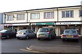
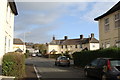
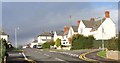
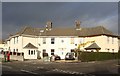
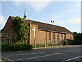
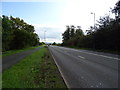
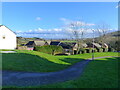
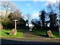
100 photos from this area
Area Information
Key information about the NP16 5AR including its size, population, and administrative classification.
- Area Type
- Postcode
- Area Size
- 1.8 hectares
- Population
- 1632
- Population Density
- 923 people/km²
House Prices in NP16 5AR
38
Properties
£145,056
Average Sold Price
£47,000
Lowest Price
£310,000
Highest Price
Showing 38 properties
| Address | Type | Beds | Baths | Last Sale Price | Last Sale Date | |
|---|---|---|---|---|---|---|
| 29 Burnt Barn Road, Bulwark, Chepstow, NP16 5AR | Terraced | 3 | 1 | £247,500 | Aug 2024 | |
| 37 Burnt Barn Road, Bulwark, Chepstow, NP16 5AR | Semi-detached | 3 | 1 | £310,000 | May 2023 | |
| 14 Burnt Barn Road, Bulwark, Chepstow, NP16 5AR | house | - | - | £220,000 | Feb 2021 | |
| 17 Burnt Barn Road, Bulwark, Chepstow, NP16 5AR | Terraced | 3 | 1 | £200,000 | Jan 2020 | |
| 8 Burnt Barn Road, Bulwark, Chepstow, NP16 5AR | Semi-detached | 3 | 1 | £255,000 | Jul 2019 | |
| 18 Burnt Barn Road, Bulwark, Chepstow, NP16 5AR | house | - | - | £231,000 | Dec 2018 | |
| 11 Burnt Barn Road, Bulwark, Chepstow, NP16 5AR | house | - | - | £136,500 | Oct 2014 | |
| 23 Burnt Barn Road, Bulwark, Chepstow, NP16 5AR | house | - | - | £130,000 | Nov 2013 | |
| 25 Burnt Barn Road, Bulwark, Chepstow, NP16 5AR | Terraced | 3 | - | £123,500 | Sep 2013 | |
| 13 Burnt Barn Road, Bulwark, Chepstow, NP16 5AR | house | - | - | £135,000 | Jun 2013 |
Page 1 of 4
Energy Efficiency in NP16 5AR
Amenities
Schools
| Rank | School | Type | Entry gender | Ages |
|---|
Explore more schools in this area
Go to Schools tabDemographics
Household Size
Two person
most common
Accommodation Type
Houses
most common
Tenure
62
majority
Ethnic Group
White
most common
Religion
N/A
most common
Household Composition
N/A
most common
Age
47
median
Adults (30-64 years)
most common
Household Deprivation
N/A
with no deprivation
NS-SEC
31
in Lower managerial occupations
Explore more demographic insights in this area
Go to Demographics tabPlanning
Planning Constraints
- Flood RiskPremium
- Ramsar Wetland SitesPremium
- Area of Outstanding Natural BeautyPremium
- Protected Nature ReservePremium
- Protected WoodlandPremium
- Crime RiskPremium