Area Overview for NP15 2JZ
Photos of NP15 2JZ
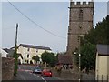
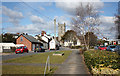
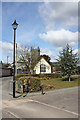
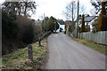

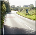
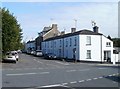
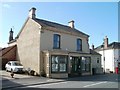
100 photos from this area
Area Information
Key information about the NP15 2JZ including its size, population, and administrative classification.
- Area Type
- Postcode
- Area Size
- 1.9 hectares
- Population
- 1930
- Population Density
- 52 people/km²
House Prices in NP15 2JZ
15
Properties
£307,727
Average Sold Price
£40,000
Lowest Price
£450,000
Highest Price
Showing 15 properties
| Address | Type | Beds | Baths | Last Sale Price | Last Sale Date | |
|---|---|---|---|---|---|---|
| 6 Castle Road, Raglan, NP15 2JZ | Detached | 3 | 1 | £430,000 | May 2024 | |
| Damson Cottage, Castle Road, Raglan, NP15 2JZ | house | - | - | £430,000 | Nov 2021 | |
| Oaklands, Castle Road, Raglan, NP15 2JZ | house | - | - | £450,000 | May 2021 | |
| 12 Castle Road, Raglan, NP15 2JZ | house | - | - | £350,000 | Mar 2020 | |
| Newbrook, 16 Castle Road, Raglan, NP15 2JZ | Detached | 3 | 1 | £360,000 | Jan 2016 | |
| Ty Enfys, 18 Castle Road, Raglan, NP15 2JZ | Detached | 3 | - | £375,000 | Dec 2015 | |
| 4 Castle Road, Raglan, NP15 2JZ | house | - | - | £330,000 | Dec 2012 | |
| Cherry Tree Cottage, Castle Road, Raglan, NP15 2JZ | house | 2 | - | £209,000 | Jan 2012 | |
| Parklands, 2 Castle Road, Raglan, NP15 2JZ | Detached | - | - | £240,000 | Sep 2007 | |
| 14 Castle Road, Raglan, NP15 2JZ | Detached | 4 | 1 | £171,000 | Mar 2000 |
Page 1 of 2
Energy Efficiency in NP15 2JZ
Amenities
Schools
| Rank | School | Type | Entry gender | Ages |
|---|
Explore more schools in this area
Go to Schools tabDemographics
Household Size
Two person
most common
Accommodation Type
Houses
most common
Tenure
76
majority
Ethnic Group
White
most common
Religion
N/A
most common
Household Composition
N/A
most common
Age
47
median
Adults (30-64 years)
most common
Household Deprivation
N/A
with no deprivation
NS-SEC
42
in Lower managerial occupations
Explore more demographic insights in this area
Go to Demographics tabPlanning
Planning Constraints
- Flood RiskPremium
- Ramsar Wetland SitesPremium
- Area of Outstanding Natural BeautyPremium
- Protected Nature ReservePremium
- Protected WoodlandPremium
- Crime RiskPremium