Area Overview for NP15 1LR
Photos of NP15 1LR
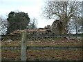

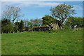
35 photos from this area
Area Information
Key information about the NP15 1LR including its size, population, and administrative classification.
- Area Type
- Postcode
- Area Size
- 3.1 km²
- Population
- 1814
- Population Density
- 28 people/km²
House Prices in NP15 1LR
18
Properties
£818,333
Average Sold Price
£345,000
Lowest Price
£1,450,000
Highest Price
Showing 18 properties
| Address | Type | Beds | Baths | Last Sale Price | Last Sale Date | |
|---|---|---|---|---|---|---|
| Nant Y Coed, Llwynau Lane, Pen Y Cae Mawr, NP15 1LR | Retail | 4 | 4 | £1,450,000 | Nov 2022 | |
| Pwll Bach Cottage, Pwll Bach To White Hall, Pen Y Cae Mawr, NP15 1LR | house | - | - | £345,000 | Apr 2016 | |
| Llwyna Farm, Llwynau Lane, Pen Y Cae Mawr, NP15 1LR | Detached | 4 | 2 | £660,000 | May 2004 | |
| Llwyna Lands Farm, Llwynau Lane, Pen Y Cae Mawr, NP15 1LR | Detached | 4 | 2 | - | - | |
| Llwynau Cottage, Llwynau Lane, Pen Y Cae Mawr, NP15 1LR | Detached | 4 | 7 | - | - | |
| Owls Hoot Barn, Llwynau Lane, Pen Y Cae Mawr, NP15 1LR | Semi-detached | 4 | 7 | - | - | |
| Whitehall Farm, Llwynau Lane, Pen Y Cae Mawr, NP15 1LR | Detached | - | - | - | - | |
| Willowdene, Pwll Bach To White Hall, Pen Y Cae Mawr, NP15 1LR | Detached | - | - | - | - | |
| Bertholey House Farm, Pwll Bach To White Hall, Pen Y Cae Mawr, NP15 1LR | Detached | - | - | - | - | |
| Gardeners Cottage, Bertholey House Farm, Pwll Bach To White Hall, Pen Y Cae Mawr, NP15 1LR | house | - | - | - | - |
Page 1 of 2
Energy Efficiency in NP15 1LR
Amenities
Schools
| Rank | School | Type | Entry gender | Ages |
|---|
Explore more schools in this area
Go to Schools tabDemographics
Household Size
Two person
most common
Accommodation Type
Houses
most common
Tenure
82
majority
Ethnic Group
White
most common
Religion
N/A
most common
Household Composition
N/A
most common
Age
47
median
Adults (30-64 years)
most common
Household Deprivation
N/A
with no deprivation
NS-SEC
47
in Lower managerial occupations
Explore more demographic insights in this area
Go to Demographics tabPlanning
Planning Constraints
- Flood RiskPremium
- Ramsar Wetland SitesPremium
- Area of Outstanding Natural BeautyPremium
- Protected Nature ReservePremium
- Protected WoodlandPremium
- Crime RiskPremium