Area Overview for NP15 1AT
Photos of NP15 1AT
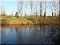
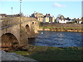
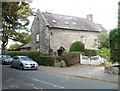
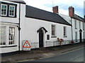
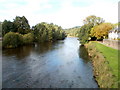
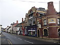
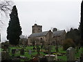
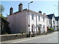
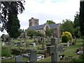

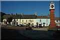
99 photos from this area
Area Information
Key information about the NP15 1AT including its size, population, and administrative classification.
- Area Type
- Postcode
- Area Size
- 1.5 hectares
- Population
- 1421
- Population Density
- 959 people/km²
House Prices in NP15 1AT
18
Properties
£352,956
Average Sold Price
£64,000
Lowest Price
£800,000
Highest Price
Showing 18 properties
| Address | Type | Beds | Baths | Last Sale Price | Last Sale Date | |
|---|---|---|---|---|---|---|
| Min Yr Afon, 20A New Market Street, Usk, NP15 1AT | Detached | 6 | - | £400,000 | Nov 2019 | |
| 14 New Market Street, Usk, NP15 1AT | house | 4 | - | £450,000 | May 2018 | |
| Ivy House, 24 New Market Street, Usk, NP15 1AT | Terraced | - | - | £800,000 | Mar 2018 | |
| 12 New Market Street, Usk, NP15 1AT | Semi-detached | 4 | - | £381,100 | May 2014 | |
| 18 New Market Street, Usk, NP15 1AT | house | - | - | £315,000 | Apr 2011 | |
| 6 New Market Street, Usk, NP15 1AT | Terraced | - | - | £202,500 | May 2008 | |
| 20 New Market Street, Usk, NP15 1AT | Detached | - | - | £249,000 | Sep 2007 | |
| Lawns Lodge, New Market Street, Usk, NP15 1AT | Detached | - | - | £315,000 | Aug 2001 | |
| 4 New Market Street, Usk, NP15 1AT | Terraced | 2 | 1 | £64,000 | Jun 1995 | |
| Henllys, New Market Street, Usk, NP15 1AT | Terraced | 2 | 2 | - | - |
Page 1 of 2
Energy Efficiency in NP15 1AT
Amenities
Schools
| Rank | School | Type | Entry gender | Ages |
|---|
Explore more schools in this area
Go to Schools tabDemographics
Household Size
Two person
most common
Accommodation Type
Houses
most common
Tenure
77
majority
Ethnic Group
White
most common
Religion
N/A
most common
Household Composition
N/A
most common
Age
47
median
Adults (30-64 years)
most common
Household Deprivation
N/A
with no deprivation
NS-SEC
48
in Lower managerial occupations
Explore more demographic insights in this area
Go to Demographics tabPlanning
Planning Constraints
- Flood RiskPremium
- Ramsar Wetland SitesPremium
- Area of Outstanding Natural BeautyPremium
- Protected Nature ReservePremium
- Protected WoodlandPremium
- Crime RiskPremium