Area Overview for Llantilio Pertholey Community
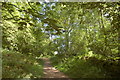
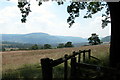
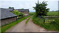
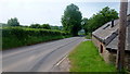
Photos of Llantilio Pertholey Community


Area Information
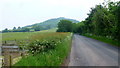
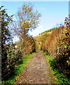
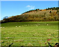
Living in Llantilio Pertholey Community offers a distinctly quiet life within a civil parish that spans 19.0 km² of Wales. This area is not defined by city noise or high-density living; instead, its daily rhythm is set by a spacious rural landscape. Prospective buyers should expect a neighbourhood where space is a primary feature, separating homes from one another in ways urban developments rarely manage. The parish provides a self-contained environment where residents commute outward rather than crowd inward, fostering a lifestyle centred on local knowledge of the land and the immediate route network. **Homes in Llantilio Pertholey Community** appeal to those who value separation and established surroundings over urban convenience. You will find yourself entering an area where the definition of a neighbourhood is physical proximity to fields and green corridors rather than fronting onto a busy street. The parish structure informs a community identity that relies on local interaction rather than transient commercial hubs. Your daily life here involves navigating a specific set of local roads and engaging with a population that has settled into these boundaries for generations. Understanding this scale helps you visualise exactly what **living in Llantilio Pertholey Community** entails before you view a single property.
- Area Type
- Parish
- Area Size
- 19.0 km²
- Population
- Not available
- Population Density
- Not available
Demographics
The people of Llantilio Pertholey Community represent a very settled demographic with a median age of 70 years. This figure indicates that the area hosts a significant elderly population, likely living in multi-generational family homes or long-term council properties. When evaluating **homes in Llantilio Pertholey Community**, you must account for a lack of young families or transient professional tenants. The most common age range spans the entire demographic total, reinforcing that the community does not fluctuate with typical population cycles. Home ownership stands at a remarkable 82 per cent within these boundaries. This statistic confirms that the housing stock is predominantlyowner-occupied rather than available for private rent. You will find few shared ownership schemes or student apartments here; the typical resident has likely lived in their current home for decades. This stability creates a predictable neighbourhood character but limits the tenant base if you are seeking a rental property. Furthermore, the household composition data reflects a total snapshot of a population that does not mirror the transient nature of modern city quarters. **Llantilio Pertholey Community** is a place defined by long stay and deep local roots rather than demographic turnover.
Household Size
Accommodation Type
Tenure
Ethnic Group
Religion
Household Composition
Age
Household Deprivation
NS-SEC
Explore more demographic insights in this area
Go to Demographics tabPlanning
Planning Constraints
- Flood RiskPremium
- Ramsar Wetland SitesPremium
- Area of Outstanding Natural BeautyPremium
- Protected Nature ReservePremium
- Protected WoodlandPremium
- Crime RiskPremium