Area Overview for Llanfoist Fawr Community
Photos of Llanfoist Fawr Community
Area Information
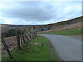
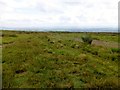
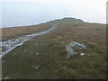
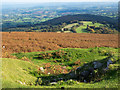
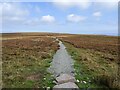
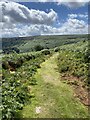
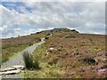
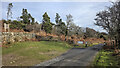
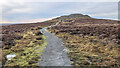
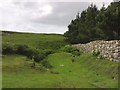
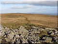
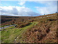
Living in Llanfoist Fawr Community offers a distinct lifestyle within a civil parish of 29.6 square kilometres. You will find yourself in a setting where space is a defined characteristic of daily life. The area spans a significant footprint that supports a variety of rural and residential experiences. This civil parish provides a structured environment for those seeking a grounded, localised way of life away from the denser population hubs of Wales. The sheer size of the parish allows for a degree of privacy and separation that larger towns cannot match. Residents here manage their lives within a clearly defined boundary that balances isolation with proximity to wider networks. The self-contained nature of the community means that many essential aspects of living happen locally before turning to larger centres for specialised needs. You can appreciate the scale of the land you call home when you consider the 29.6 km² area. This region has developed organic patterns of settlement over time, resulting in a layout where gardens are important and proximity to the road is not always immediate. The identity of Llanfoist Fawr Community is rooted in this substantial geographical presence, which shapes everything from travel times to the feeling of space around your property. When you consider homes in Llanfoist Fawr Community, you are choosing a location where the physical environment plays a major role in your quality of life. The parish acts as a container for a specific type of Welsh living that values room and established boundaries. This context is vital for anyone evaluating whether this civil parish fits their long-term residential plans. The facts on the ground support a narrative of a place defined by its size and its status as a defined administrative unit.
- Area Type
- Parish
- Area Size
- 29.6 km²
- Population
- Not available
- Population Density
- Not available
Demographics
The demographic profile of Llanfoist Fawr Community presents a clear picture of an established residential area. The median age of residents is 70, indicating that the local population skews significantly older than the national average. This age distribution suggests that the area has attracted people looking for quieter lives or is a retirement-focused location for many incoming and existing households. When you review the age data, the concentration in the primary age group aligns with the higher life expectancy found in many rural Welsh parishes. Home ownership stands at 70%, which is a key indicator of the financial stability of the people living here. A majority of residents have long-term ties to the area, having purchased properties rather than renting year to year. This high level of ownership typically correlates with local knowledge and community involvement. The household composition data reflects traditional family units and singles, though specific breakdowns are not detailed in the current records. You can expect a community where neighbours have known one another for decades, given the strong owner-occupied demographic. The accommodation types and ethnic diversity are recorded as total categories, suggesting a standardised reporting method common in Welsh civil parishes. This stability is evident in the fact that 70% of homes are owned outright or have a mortgage. For those considering living in Llanfoist Fawr Community, the data signals a shift away from transient populations towards settled residents. The median age of 70years is a defining statistic that shapes the local services, social habits, and overall rhythm of life in this parish.
Household Size
Accommodation Type
Tenure
Ethnic Group
Religion
Household Composition
Age
Household Deprivation
NS-SEC
Explore more demographic insights in this area
Go to Demographics tabPlanning
Planning Constraints
- Flood RiskPremium
- Ramsar Wetland SitesPremium
- Area of Outstanding Natural BeautyPremium
- Protected Nature ReservePremium
- Protected WoodlandPremium
- Crime RiskPremium