Area Overview for Llandogo
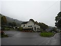
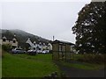
Photos of Llandogo


Area Information
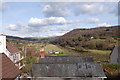
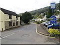
Llandogo is a built-up area in Wales encompassing 34.0 hectares. It sits within the greater Bristol and Bath corridor, offering a residential focus rather than major commercial density. The median age of residents is 70, which defines the demographic spine of the community. This figure indicates that older adults form the core of the population. Consequently, daily life here operates with a slower pace compared to high-density urban centres. Homes in Llandogo cater primarily to retirees or those seeking a quieter retirement setting. The area does not resemble a bustling city centre but functions as a self-contained neighbourhood. You will find that the streets are designed for local living rather than heavy through-traffic. The atmosphere is steady and established, reflecting a community where residents have deep roots. Living in Llandogo means accepting that facilities are located within walking or short driving distance rather than immediately adjacent to every street. The area provides a clear example of how built-up regions in this part of Wales support an older demographic. Practical convenience depends on your proximity to the few key amenities nearby. The environment is suitable for those who prefer stability over rapid change.
- Area Type
- Built Up Area 250
- Area Size
- 34.0 hectares
- Population
- Not available
- Population Density
- Not available
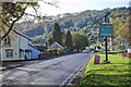
Residents of Llandogo enjoy practical access to essential amenities within a short drive or walk. The area hosts five retail outlets, with notable options including a Co-op Bream and two Spar stores. These shops provide the basics for daily shopping needs without requiring a long journey. For transport enthusiasts, the area is near two railway stations: Parkend and the Dean Forest Railway. The Dean Forest Railway offers a heritage railway experience for leisurely outings. Parkend provides a connection to the wider rail network for commuting or regional travel. You will find that shopping trips are manageable without leaving the immediate neighbourhood thanks to the nearby Co-op and Spar locations. The presence of these specific retailers indicates a focus on convenience food and household essentials. Leisure activities are enhanced by the proximity to historic railways, offering a unique local interest point. While the area lacks large shopping centres, the distribution of essential shops supports a self-sufficient lifestyle. Residents can attend to their regular grocery shopping at the Co-op or Spar without significant travel time. The combination of local retail and nearby rail stations creates a balanced lifestyle option.
Amenities
Schools
The nearest educational facility to Llandogo is Llandogo C.P. School. This institution is listed as a primary school within the broader category of 'other' school types available to the local community. There are no secondary schools located directly on the data provided for this specific built-up area. Families living in Llandogo likely rely on this primary provision for their children until they reach secondary school age. Once children leave primary education, they typically travel to secondary institutions outside the immediate vicinity. The absence of a secondary school on this list suggests that Llandogo serves as a residential suburb for pupils attending larger schools elsewhere. For parents, this means that school runs will involve travel distance rather than a local cluster of educational options. The presence of Llandogo C.P. School provides a local anchor for early education but does not indicate a comprehensive school system within the 34.0 hectares of the area itself. You must consider transport logistics carefully if you are choosing based solely on school proximity. The school type listing confirms the presence of primary education but leaves the secondary phase to external arrangements.
| Rank | A + A* % | School | Type | Entry gender | Ages |
|---|---|---|---|---|---|
| 1 | N/A | Llandogo C.P. School | other | N/A | N/A |
Explore more schools in this area
Go to Schools tabDemographics
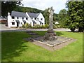
The community in Llandogo is defined by a predominantly elderly population. The median age reaches 70 years, making this the most common age profile for residents. This demographic reality shapes the social fabric of the area. Eighty-six per cent of households own their homes, which is a notably high ownership rate. Only one in six residents rents their accommodation. This statistic confirms that Llandogo is an owner-occupied area where stability is the norm. The low rental proportion means the housing market is driven by existing owners and downsizers rather than young tenants or investors. Accommodation types align with this ownership pattern, suggesting a stock that suits long-term settlement. The household composition reflects families that have remained in one place for many years. Diversity in ethnicity and religion is present but secondary to the age factor in defining community character. For a prospective buyer, this data suggests a mature, settled environment where change happens slowly. The concentration of older homeowners implies that the area has undergone previous development waves suited for retirement. You should expect a community where neighbours know each other well and where the social network is established.
Household Size
Accommodation Type
Tenure
Ethnic Group
Religion
Household Composition
Age
Household Deprivation
NS-SEC
Explore more demographic insights in this area
Go to Demographics tabPlanning
Planning Constraints
- Crime RiskLocked