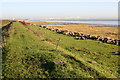
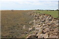
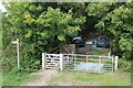
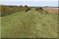
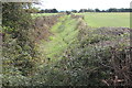
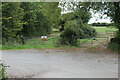
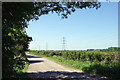
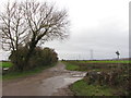
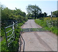
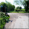
Area Overview for Rogiet Community
Photos of Rogiet Community


Area Information
Living in Rogiet Community offers a distinct semi-rural experience within a civil parish in Wales. You will find yourself in an area covering 20.3 square kilometres, providing a spread of open space rather than a densely packed urban centre. The community feels established and tranquil, suitable for those seeking a slower pace of life while maintaining access to local amenities. Daily life here revolves around the character of a traditional parish, where neighbours often know each other and the environment takes precedence over high-rise development. This location is defined by its wide boundaries and lack of major planning constraints such as Areas of Outstanding Natural Beauty, yet it retains natural features that shape the landscape. Prospective buyers should appreciate that this is a space where you own your surroundings for the long term. With a median age of 70, the rhythm of life moves at a gentler tempo compared to city centres. You are entering a well-defined residential zone where the demographic makes up a consistent profile of older residents. The seventy-eight per cent home ownership rate indicates a stable settlement where people have put down roots for generations. Houses here are not merely assets but permanent residences for their current occupants. This creates a settled atmosphere where families and individuals enjoy the peace of country living without the isolation of remote hamlets. The community in Rogiet Community is defined by its older demographic profile. You will find that the median age stands at 70, meaning half of the population is older than this figure. This age distribution significantly influences the social fabric of the parish. Household composition reflects this demographic trend, with a high proportion of residents living in established homes rather than transient flats. The level of home ownership is substantial, accounting for 78 per cent of all households. This figure demonstrates that the majority of residents own their properties, creating a stable residential environment. The area does not have a high concentration of rented accommodation, which is typical of rural parishes with strong owner-occupier traditions. Accommodation types generally favour traditional family homes adapted for later life rather than young professional housing. Regarding diversity, the data indicates a homogeneous population structure common in rural Welsh parishes. You should expect a community with deep local connections and low population turnover. Deprivation levels tend to be lower in such owner-dominated areas, though specific deprivation indices are not detailed in the current data. The older age profile means that local services must cater to the needs of retirees, including healthcare access and social activities. Traffic volumes will generally be lower than in urban centres, contributing to a quieter living environment. The property market in Rogiet Community is overwhelmingly characterised by owner-occupation, with 78 per cent of households owning their homes. This statistic reveals a market where investments are long-term rather than speculative. You are unlikely to encounter a large Lettings Agency presence or a high volume of transient tenants. The housing stock is composed primarily of residential properties suited to older occupants or families looking for retirement locations. Accommodation types in the parish reflect the 20.3 square kilometre footprint, likely featuring detached or semi-detached houses rather than high-density apartments. This structure makes Rogiet Community ideal for buyers seeking a mortgage to purchase a permanent home rather than those navigating the private rental sector. The high ownership rate suggests that price stability may be influenced by the aged demographic, potentially affecting the pace of property transactions. If you are looking to buy homes in Rogiet Community, prepare for a market that values stability over rapid turnover. Sellers here are often motivated by life changes, such as moving into care facilities or downsizing. You will find a buyer pool that understands the value of established gardens and wooded land. The lack of significant student housing or young professional blocks in the data confirms that this is not a commuter belt hub. Instead, it functions as a self-contained residential parish where home ownership is the norm. Digital connectivity in Rogiet Community provides a strong foundation for modern living. Fixed broadband scores 93 out of 100, which classifies the service as excellent. This high quality ensures that you can work from home without interruption or lag. High-speed internet supports video conferencing and large file transfers effectively. Mobile coverage scores 82 out of 100, indicating good signal strength across most of the parish. You can expect reliable mobile data for navigation, streaming, and emergency communication. These connectivity levels are rare for a rural parish of 20.3 square kilometres. They suggest that infrastructure investments have successfully mitigated common rural isolation issues. Working remotely from Rogiet Community is feasible day-to-day. You do not need to travel to the nearest town for digital tasks. The combination of excellent fixed broadband and good mobile coverage supports all standard digital requirements. Streaming 4K content and online banking will function as smoothly as they do in urban centres. For those who rely heavily on internet-enabled smart homes, this area meets most modern expectations. The connectivity scores remove the barrier often associated with buying a rural property. You can buy with confidence knowing your home will support daily digital needs. Safety and environmental planning in Rogiet Community present a mixed picture of risk factors and protections. You will find a low flood risk coverage with a safety pass, indicating minimal threat from rising water. This assessment provides reassurance for long-term property planning. However, you must consider planning constraints if you intend to modify your land. The area contains Ramsar wetland sites and protected nature reserves, both flagged with warnings. These designations limit construction possibilities and require careful management of any landscaping projects. Protected woodland also exists within the parish boundaries, further restricting development options. While these features preserve the natural beauty, they impose legal obligations on land use. Specific crime risk data is not currently available as the statistics only cover England. Therefore, you cannot rely on official crime figures for this Welsh parish. You should rely on local observation and community knowledge to gauge security levels. The environmental warnings do not imply danger but rather regulatory restrictions. If you plan to build an extension or install a fence, check the boundaries against the protected sites. The lack of flood risk is a significant positive for home insurance and mortgage approval. Balancing the planning constraints with the safety pass will be key to your decision-making process. Is Rogiet Community known for its mature residents?Yes, the community is distinctly older. The median age in Rogiet Community is 70, and 78 per cent of households own their homes. This high ownership rate points to a stable population of retirees and families seeking a permanent rural base rather than a transient rental market. How are the broadband and mobile networks in Rogiet Community?The digital infrastructure is robust for a rural parish. You can expect excellent fixed broadband with a quality score of 93 and good mobile coverage scoring 82. These figures mean you can work from home reliably without the connectivity issues often found in country properties. What are the main environmental hazards to consider?While flood risk is low, the area has specific planning constraints. The parish contains Ramsar wetland sites, protected nature reserves, and protected woodland. These features are flagged with warnings, meaning you may face restrictions on construction or land alteration if your property is nearby these designated zones. Is the area safe from crime?Official crime statistics are not available for this area because the data only covers England. You will need to rely on local community awareness to assess security levels in Rogiet Community. The low flood risk and lack of high-crime indicators in similar parishes often contribute to a peaceful environment.
- Area Type
- Parish
- Area Size
- 20.3 km²
- Population
- Not available
- Population Density
- Not available
Demographics
The community in Rogiet Community is defined by its older demographic profile. You will find that the median age stands at 70, meaning half of the population is older than this figure. This age distribution significantly influences the social fabric of the parish. Household composition reflects this demographic trend, with a high proportion of residents living in established homes rather than transient flats. The level of home ownership is substantial, accounting for 78 per cent of all households. This figure demonstrates that the majority of residents own their properties, creating a stable residential environment. The area does not have a high concentration of rented accommodation, which is typical of rural parishes with strong owner-occupier traditions. Accommodation types generally favour traditional family homes adapted for later life rather than young professional housing. Regarding diversity, the data indicates a homogeneous population structure common in rural Welsh parishes. You should expect a community with deep local connections and low population turnover. Deprivation levels tend to be lower in such owner-dominated areas, though specific deprivation indices are not detailed in the current data. The older age profile means that local services must cater to the needs of retirees, including healthcare access and social activities. Traffic volumes will generally be lower than in urban centres, contributing to a quieter living environment. The property market in Rogiet Community is overwhelmingly characterised by owner-occupation, with 78 per cent of households owning their homes. This statistic reveals a market where investments are long-term rather than speculative. You are unlikely to encounter a large Lettings Agency presence or a high volume of transient tenants. The housing stock is composed primarily of residential properties suited to older occupants or families looking for retirement locations. Accommodation types in the parish reflect the 20.3 square kilometre footprint, likely featuring detached or semi-detached houses rather than high-density apartments. This structure makes Rogiet Community ideal for buyers seeking a mortgage to purchase a permanent home rather than those navigating the private rental sector. The high ownership rate suggests that price stability may be influenced by the aged demographic, potentially affecting the pace of property transactions. If you are looking to buy homes in Rogiet Community, prepare for a market that values stability over rapid turnover. Sellers here are often motivated by life changes, such as moving into care facilities or downsizing. You will find a buyer pool that understands the value of established gardens and wooded land. The lack of significant student housing or young professional blocks in the data confirms that this is not a commuter belt hub. Instead, it functions as a self-contained residential parish where home ownership is the norm. Digital connectivity in Rogiet Community provides a strong foundation for modern living. Fixed broadband scores 93 out of 100, which classifies the service as excellent. This high quality ensures that you can work from home without interruption or lag. High-speed internet supports video conferencing and large file transfers effectively. Mobile coverage scores 82 out of 100, indicating good signal strength across most of the parish. You can expect reliable mobile data for navigation, streaming, and emergency communication. These connectivity levels are rare for a rural parish of 20.3 square kilometres. They suggest that infrastructure investments have successfully mitigated common rural isolation issues. Working remotely from Rogiet Community is feasible day-to-day. You do not need to travel to the nearest town for digital tasks. The combination of excellent fixed broadband and good mobile coverage supports all standard digital requirements. Streaming 4K content and online banking will function as smoothly as they do in urban centres. For those who rely heavily on internet-enabled smart homes, this area meets most modern expectations. The connectivity scores remove the barrier often associated with buying a rural property. You can buy with confidence knowing your home will support daily digital needs. Safety and environmental planning in Rogiet Community present a mixed picture of risk factors and protections. You will find a low flood risk coverage with a safety pass, indicating minimal threat from rising water. This assessment provides reassurance for long-term property planning. However, you must consider planning constraints if you intend to modify your land. The area contains Ramsar wetland sites and protected nature reserves, both flagged with warnings. These designations limit construction possibilities and require careful management of any landscaping projects. Protected woodland also exists within the parish boundaries, further restricting development options. While these features preserve the natural beauty, they impose legal obligations on land use. Specific crime risk data is not currently available as the statistics only cover England. Therefore, you cannot rely on official crime figures for this Welsh parish. You should rely on local observation and community knowledge to gauge security levels. The environmental warnings do not imply danger but rather regulatory restrictions. If you plan to build an extension or install a fence, check the boundaries against the protected sites. The lack of flood risk is a significant positive for home insurance and mortgage approval. Balancing the planning constraints with the safety pass will be key to your decision-making process. Is Rogiet Community known for its mature residents?Yes, the community is distinctly older. The median age in Rogiet Community is 70, and 78 per cent of households own their homes. This high ownership rate points to a stable population of retirees and families seeking a permanent rural base rather than a transient rental market. How are the broadband and mobile networks in Rogiet Community?The digital infrastructure is robust for a rural parish. You can expect excellent fixed broadband with a quality score of 93 and good mobile coverage scoring 82. These figures mean you can work from home reliably without the connectivity issues often found in country properties. What are the main environmental hazards to consider?While flood risk is low, the area has specific planning constraints. The parish contains Ramsar wetland sites, protected nature reserves, and protected woodland. These features are flagged with warnings, meaning you may face restrictions on construction or land alteration if your property is nearby these designated zones. Is the area safe from crime?Official crime statistics are not available for this area because the data only covers England. You will need to rely on local community awareness to assess security levels in Rogiet Community. The low flood risk and lack of high-crime indicators in similar parishes often contribute to a peaceful environment.
Household Size
Accommodation Type
Tenure
Ethnic Group
Religion
Household Composition
Age
Household Deprivation
NS-SEC
Explore more demographic insights in this area
Go to Demographics tabPlanning
Planning Constraints
- Flood RiskPremium
- Ramsar Wetland SitesPremium
- Area of Outstanding Natural BeautyPremium
- Protected Nature ReservePremium
- Protected WoodlandPremium
- Crime RiskPremium