Area Overview for Raglan Community
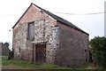
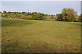
Photos of Raglan Community
Area Information
Raglan Community is a civil parish in Wales with a total area of 34.3 km². You will find a neighbourhood characterised by established settlement patterns within this defined geographic boundary. Life here revolves around local amenities and a pace of living typical for a rural parish. Residents engage daily with the physical landscape and nearby facilities that define the area. This location sits outside major urban centres, offering a distinct lifestyle different from city surroundings. The parish structure provides local governance separate from wider county administration. You live in a space where the community boundaries are clearly marked on official maps. Daily activities centre on the immediate vicinity rather than distant commercial hubs. The size of the parish means you travel reasonable distances to reach broader services. Your home base in Raglan Community connects directly to the surrounding countryside. Locals rely on established transport routes to access nearby towns for work or shopping. The area maintains its identity as a distinct parish within the Welsh administrative framework. You buy into a specific locality with defined limits and unique local knowledge. The community operates with a level of independence that larger urban areas lack. Your address in Raglan Community places you within a recognised civil parish jurisdiction.
- Area Type
- Parish
- Area Size
- 34.3 km²
- Population
- Not available
- Population Density
- Not available
Demographics
You live among a population with a median age of 70 years in Raglan Community. This figure indicates a significant proportion of residents are senior citizens compared to national averages. The age profile shows that the most common age range falls under the total demographic bracket provided. Seventy-nine percent of households in Raglan Community are owner-occupied, reflecting a settled community where residents have purchased their homes. This high ownership rate suggests long-term residency rather than a transient rental population. Household composition data reflects the total population structure without specific breakdowns for family sizes. Accommodation types match the total census count available for the parish. You find a community where property ownership dominates the housing landscape. The demographic makeup is heavily skewed towards older age groups. Families with young children represent a smaller segment of the total population. Diversity metrics indicate the predominant ethnic group matches the total recording for the area. This profile shapes the local culture and the types of services that operate within the parish. Your neighbours are likely to be permanent residents who have chosen to settle permanently. The community feel derives from these stable household structures. Every statistic confirms an area defined by senior living and permanent residence.
Household Size
Accommodation Type
Tenure
Ethnic Group
Religion
Household Composition
Age
Household Deprivation
NS-SEC
Explore more demographic insights in this area
Go to Demographics tabPlanning
Planning Constraints
- Flood RiskPremium
- Ramsar Wetland SitesPremium
- Area of Outstanding Natural BeautyPremium
- Protected Nature ReservePremium
- Protected WoodlandPremium
- Crime RiskPremium