Area Overview for Llanelly Community
Photos of Llanelly Community
Area Information
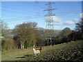
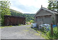
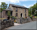
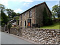
Living in Llanelly Community offers a distinct experience within the civil parish system of Wales. This area spans 18.3 km², providing a specific geographical footprint for residents. The location presents a quiet lifestyle defined by its administrative status as a parish. You can find homes in Llanelly Community in a setting that prioritises established local patterns over rapid urban change. Daily life here revolves around the practicalities of a defined parish boundary. The area size allows for a sense of space without the density of larger towns. Prospective buyers often seek this specific type of settlement when considering moves to Wales. You will find that life in Llanelly Community involves navigating a layout designed for its current population needs. The parish structure influences how services and community activities are organised for those calling this place home. Understanding the scale of this 18.3 km² zone helps you gauge the environment accurately. Homes in Llanelly Community exist within a framework that has remained stable for some time. This stability is evident in the way the neighbourhood operates for its inhabitants. You should consider the parish context as a core feature of your potential new home.
- Area Type
- Parish
- Area Size
- 18.3 km²
- Population
- Not available
- Population Density
- Not available
Demographics
The community profile of Llanelly Community reveals a settled population with a high level of homeownership. An impressive 81% of residents own their homes, indicating a very stable demographic. The median age for the area is 70 years, which signals that this is a retirement-focused zone. Most households in Llanelly Community are occupied by older individuals rather than young families. You will encounter a neighbourhood where life typically slows down after retirement age. The accommodation types reflect a reliance on long-term residency rather than short-term renting. This high ownership rate means the local housing market operates differently than in more transient areas. The age distribution places Llanelly Community clearly in the category of a senior-led settlement. You should expect a quiet atmosphere driven by residents in their later years. The consistency in household composition suggests little fluctuation in the types of people moving in or out. This demographic reality shapes the daily rhythm of the parish significantly.
Household Size
Accommodation Type
Tenure
Ethnic Group
Religion
Household Composition
Age
Household Deprivation
NS-SEC
Explore more demographic insights in this area
Go to Demographics tabPlanning
Planning Constraints
- Flood RiskPremium
- Ramsar Wetland SitesPremium
- Area of Outstanding Natural BeautyPremium
- Protected Nature ReservePremium
- Protected WoodlandPremium
- Crime RiskPremium