Area Overview for Gobion Fawr Community
Photos of Gobion Fawr Community
Area Information
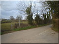
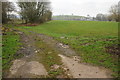
Living in Gobion Fawr Community means residing within a civil parish in Monmouthshire that spans 40.5 square kilometres. This rural expanse is defined by farming settlements and historic locations such as Llanfair Kilgeddin, which sits along the River Usk and the B4598 road. The area functions as a small community deeply rooted in history, having existed under names like Rhyd-y-Meirch and Llanddewi Rhydderch for over seven centuries. Today, the parish forms part of the larger Llanover estate, a fact that shapes the local landscape and ownership patterns. You will find traditional stone homes and modern constructions set against a backdrop of medieval sites, including a motte and bailey castle and the Grade II listed St Bartholomew's Church. Daily life here involves navigating narrow roads and appreciating the quiet seclusion of the Welsh countryside. The community council actively manages local affairs, reflecting a strong desire to preserve the parish's identity despite urban encroachment. For those seeking a location with tangible history and open space, Gobion Fawr offers a distinct character separate from the more developed towns nearby.
- Area Type
- Parish
- Area Size
- 40.5 km²
- Population
- Not available
- Population Density
- Not available
Demographics
The demographic profile of Gobion Fawr Community reflects a distinct rural retirement settlement. The median age for residents is 70 years, indicating that the population is significantly older than the national average. This age distribution suggests the area attracts or hosts a large retirement cohort. Home ownership stands at a robust 60%, a figure typical for established rural parishes where residents purchase properties to stay long-term. The household composition data indicates a total assessment where specific single-person or family breakdowns are aggregated under general totals. While specific percentages for accommodation types are not broken down further in the available records, the high ownership rate implies a stable, settled population rather than a transient rental market. Ethnic diversity data shows that the predominant groups have been assessed but specific percentages are not detailed in the current figures. Religion records also exist as total assessments without specific denominational splits. This demographic picture paints a community of settled homeowners, likely drawn by the quiet living conditions and the historic charm of the parish.
Household Size
Accommodation Type
Tenure
Ethnic Group
Religion
Household Composition
Age
Household Deprivation
NS-SEC
Explore more demographic insights in this area
Go to Demographics tabPlanning
Planning Constraints
- Flood RiskPremium
- Ramsar Wetland SitesPremium
- Area of Outstanding Natural BeautyPremium
- Protected Nature ReservePremium
- Protected WoodlandPremium
- Crime RiskPremium