Area Overview for Devauden Community
Photos of Devauden Community
Area Information
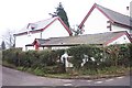
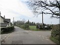
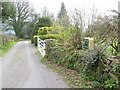
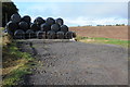
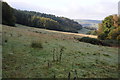
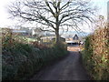
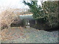
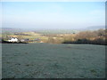
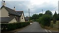
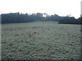
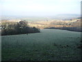
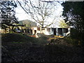
Living in Devauden Community offers a distinct experience within Monmouthshire, southeast Wales. This unitary electoral division spans 41.3 square kilometres, encompassing the core village of Devauden alongside Itton, Wolvesnewton, Llanfihangel-tor-y-mynydd, and Newchurch. The area sits on the B4293 road near the top of the Trellech ridge, positioning it strategically between the market towns of Chepstow and Monmouth. Its name likely derives from the Welsh *Ty'r ffawydden*, meaning the house of the beech tree, hinting at a landscape deeply connected to local trees and agriculture. Daily life here reflects a blend of rural history and quiet modern living. The parish contains notable features such as the former National School, which operated from 1815 before closing in 1986, and the small parish church dedicated to St James, rebuilt in 1861. John Wesley preached his first Welsh sermon on the village green in 1739, adding a layer of historical significance to the community centre you will know. You will find the area functions as a close-knit civil parish with its own community council, formed in 1935. The geography includes the Angiddy valley and ancient ridgeways, offering residents a setting where history permeates the physical environment. Homes in Devauden Community provide access to this layered heritage without the noise of larger urban centres.
- Area Type
- Parish
- Area Size
- 41.3 km²
- Population
- Not available
- Population Density
- Not available
Demographics
The social fabric of Devauden Community is defined by a significantly older population profile. The median age stands at 70 years, indicating a resident base composed largely of retirees and long-term locals rather than families with young children. Most households fall into the total age category, suggesting a stable demographic structure where people tend to remain in the area as they age. This profile explains why the community increasingly focuses on services suitable for senior living rather than extensive childcare facilities. Home ownership in this area reaches an exceptionally high level at 83%. This statistic confirms that the housing stock is predominantly occupied by people who bought their homes, not tenants. You are unlikely to encounter a high volume of short-term rentals or transient populations; instead, residents have established deep roots. The accommodation types reflect this stability, with properties designed to stay within families for generations. Diversity statistics indicate that the predominant ethnic group forms the majority of the population, consistent with a rural Welsh parish. Religion and household composition data further support a traditional community structure. Living in Devauden Community means joining a population that values permanence, which often translates to quieter streets and neighbourhoods where everyone knows their neighbours by name.
Household Size
Accommodation Type
Tenure
Ethnic Group
Religion
Household Composition
Age
Household Deprivation
NS-SEC
Explore more demographic insights in this area
Go to Demographics tabPlanning
Planning Constraints
- Flood RiskPremium
- Ramsar Wetland SitesPremium
- Area of Outstanding Natural BeautyPremium
- Protected Nature ReservePremium
- Protected WoodlandPremium
- Crime RiskPremium