Area Overview for Caerwent Community
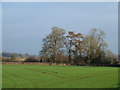
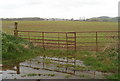
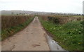
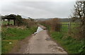
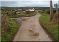
Photos of Caerwent Community


Area Information
Caerwent Community is a civil parish situated within Monmouthshire, South Wales. It lies approximately five miles west of Chepstow and eleven miles east of Newport, positioned just south of the A48 road and west of the M48 motorway. The area covers 28.2 square kilometres, offering a residence that blends rural living with significant historical importance. The settlement is defined by its archaeological heritage, built around the ruins of Venta Silurum, a Roman town founded around 75 to 80 AD. This continuous occupation site spans nearly two millennia, making daily life in Caerwent Community shaped by ancient history. You will find the modern village clustered around key landmarks such as the 13th-century Church of St Stephen and St Tathan and the late 16th-century Caerwent House. The character of the parish is quiet and pastoral, set within a valley surrounded by agricultural land. While tourism related to heritage and historical interest forms a part of the local economy, the area today maintains a distinct identity from its past as an administrative capital for the Silures tribe. The modern layout reflects 19th and 20th-century development, creating a cohesive settlement where clusters of cottages sit amongst the remains of Roman town walls and a Forum Basilica.
- Area Type
- Parish
- Area Size
- 28.2 km²
- Population
- Not available
- Population Density
- Not available
Demographics
The community profile in Caerwent Community reflects a settled, older population. The median age for residents stands at 70 years, indicating a village with a significant demographic of seniors. While specific age breakdowns beyond the median figure are not detailed in current records, the high median age suggests a slower-paced environment compared to younger convenience towns. Home ownership is a defining feature of daily life here, with 84 per cent of households owning their homes outright or with a mortgage. This high rate of ownership implies deep-rooted communities and long-term residents rather than a transient population. Accommodation data covers the total household composition, confirming that the vast majority of residents secure their living arrangements through ownership. Current demographic records do not specify the most common age range beyond the median, nor do they provide detailed figures for predominant ethnic groups or religious affiliations. However, the high level of home ownership typically correlates with stability and a lack of short-term tenancy churn. Living in Caerwent Community means joining an area where residents have invested heavily in their local environment, creating a stable social fabric for families and individuals alike.
Household Size
Accommodation Type
Tenure
Ethnic Group
Religion
Household Composition
Age
Household Deprivation
NS-SEC
Explore more demographic insights in this area
Go to Demographics tabPlanning
Planning Constraints
- Flood RiskPremium
- Ramsar Wetland SitesPremium
- Protected Nature ReservePremium
- Protected WoodlandPremium
- Crime RiskPremium