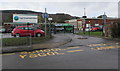
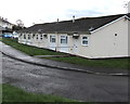
Area Overview for Troed-y-rhiw Community
Photos of Troed-y-rhiw Community


Area Information
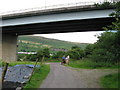
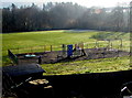
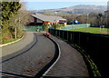
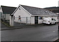
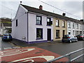
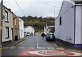
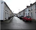
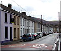
Troed-y-rhiw Community sits as a parish within the Merthyr Tydfil County Borough, tucked roughly three miles south of the town centre in the Taff Valley. You will find the village spread across an area of 21.2 square kilometres, hosting a population of 1,476 residents. This figure differs from some historical references that cite figures around 2,000, reflecting current civil parish boundaries. The modern community maintains a distinct identity rooted in its past as a coal mining village tied to ironmasters like Anthony Hill, while functioning today as a residential zone with a strong working-class heritage. Daily life here involves living in a location with a specific, quiet character away from the busiest parts of the valley. The name itself, meaning 'foot of the hill' in Welsh, hints at the geography that shapes the neighbourhood. You are choosing a place defined by deep local history, including the legacy of the Saron Welsh Congregational Chapel and earlier National Schools. Recent community efforts, such as the work of the Friends of Saron group, show how residents actively maintain local grit rather than simply letting history fade. When you consider living in Troed-y-rhiw Community, you are stepping into an area where the built environment remembers its industrial roots but now serves a quieter, predominantly residential purpose. The parish offers a tangible connection to Merthyr's broader narrative without being part of the immediate urban sprawl.
- Area Type
- Parish
- Area Size
- 21.2 km²
- Population
- 1476
- Population Density
- 1028 people/km²
Demographics
The community of Troed-y-rhiw displays a clearly defined age structure, with a median age of 70 years. This statistic indicates that the population is significantly older than the national average, suggesting a village where retirees and older adults form the core demographic. Most common age ranges skew heavily towards this older profile, which influences the pace of life and the type of local services required. Home ownership stands at 67 percent, a figure that confirms this is primarily a settled area where people have lived for decades. You are looking at a neighbourhood where stability outweighs transient living arrangements, as over two-thirds of households own their properties outright or have a mortgage. The demographic data does not specify the breakdown of ethnicity, religion, or detailed household composition figures, but the high ownership rate and age profile paint a reliable picture of a mature community. Living in Troed-y-rhiw means joining a demographic where neighbours are likely to know each other well across generations. This settled population creates a static but supportive social fabric rather than a rapidly shifting one. The absence of young families in the data points suggests you should expect a quieter, less frenetic environment compared to more mixed-age suburbs.
Household Size
Accommodation Type
Tenure
Ethnic Group
Religion
Household Composition
Age
Household Deprivation
NS-SEC
Explore more demographic insights in this area
Go to Demographics tabPlanning
Planning Constraints
- Flood RiskPremium
- Ramsar Wetland SitesPremium
- Area of Outstanding Natural BeautyPremium
- Protected Nature ReservePremium
- Protected WoodlandPremium
- Crime RiskPremium