Area Overview for Town Community
Photos of Town Community

Area Information
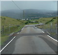
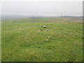
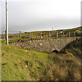
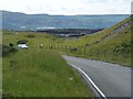
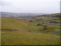
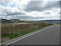
Living in Town Community means residing in a civil parish situated within Merthyr Tydfil, a town located approximately 23 miles north of Cardiff. The parish covers an area of 7.7 square kilometres and is home to a population of 1,436 residents. With a density of 188 people per square kilometre, you will find a relatively compact settlement pattern typical of a rural parish integrated into a broader industrial town. The name of the wider town originates from Saint Tydfil, an early Christian convert who was venerated as a martyr around 480 CE. This history shapes the local identity, distinguishing it from other areas in South Wales. While the modern town emerged rapidly in the late 18th century following the establishment of iron smelting works, the parish itself represents a more stable, historic portion of the landscape. You are living in a space where prehistoric evidence exists, though permanent settlement only solidified in the Middle Ages. Daily life here is defined by proximity to the historic valley that once supported extensive livestock rearing before industrialisation transformed the region into one of Wales's largest towns. The boundaries of the parish offer a connection to the agricultural roots of the area while providing access to the community amenities of Merthyr Tydfil.
- Area Type
- Parish
- Area Size
- 7.7 km²
- Population
- 1436
- Population Density
- 188 people/km²
Demographics
The community profile of Town Community is defined by an older demographic, with a median age of 70 years. This statistical reality indicates a retirement-focused population resulting in a limited number of young families residing within the parish boundaries. Home ownership stands at 64 per cent of households, suggesting a stable resident base that has settled locally over a long period. The household composition data reflects a total population structure rather than a mixed-age distribution common in newer developments. Accommodation types follow similar total-based reporting, without specific distinctions between terraced, semi-detached, or detached properties in the available figures. There is no specific data available regarding ethnic group breakdown or religious affiliation for this parish. While Merthyr Tydfil as a whole has a rich history dating back to the 18th century, including the establishment of a Hebrew congregation in 1848, the specific demographic diversity within this parish remains unquantified. You should understand that the primary resident group consists of older adults. This age profile influences local service需求和 social activities, though specific facilities are not detailed in the current record. The community lacks the younger population typically found in family-oriented zones, creating a distinct social environment centred on the needs of the elderly.
Household Size
Accommodation Type
Tenure
Ethnic Group
Religion
Household Composition
Age
Household Deprivation
NS-SEC
Explore more demographic insights in this area
Go to Demographics tabPlanning
Planning Constraints
- Flood RiskPremium
- Ramsar Wetland SitesPremium
- Area of Outstanding Natural BeautyPremium
- Protected Nature ReservePremium
- Protected WoodlandPremium
- Crime RiskPremium