Area Overview for Pant Community
Photos of Pant Community

Area Information
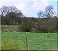
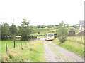
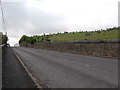
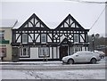
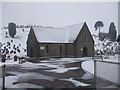
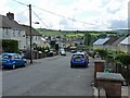
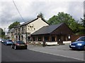
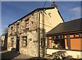
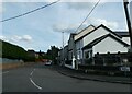
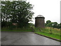
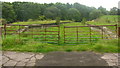
Pant Community is a civil parish within the Merthyr Tydfil County Borough in Wales, covering an area of 7.5 square kilometres. This small, defined locality sits near Dowlais in the broader industrial region of Merthyr Tydfil. Early maps reveal that Pant was originally thinly populated, consisting mainly of nine farms such as Caeracca and Pantyscallog. Today, the population stands at approximately 1,510 residents. The area holds significant historical weight, featuring the ruins of Morlais Castle, constructed around 1265, and Garth Farm, formerly known as Madoc's Castle. Local history also notes the opening of Pant Cemetery in 1849 due to overcrowding at St John's Churchyard during a cholera outbreak, alongside the construction of Christ Church in the 1870s. Living in Pant Community means inhabiting a space with deep roots in the agricultural and industrial past of South Wales. You will find landmarks like the notable iron gates of Pant Cemetery and the former site of the Pant railway station, which closed in 1960. The area has been impacted significantly by the construction of the Heads of the Valleys Road in 1963, shaping its modern transport landscape. Whether you are exploring homes in Pant Community or simply visiting, the physical setting offers a tangible connection to the region's heritage while presenting a distinct, small-scale community environment away from the city centre.
- Area Type
- Parish
- Area Size
- 7.5 km²
- Population
- Not available
- Population Density
- Not available
Demographics
The demographic profile of Pant Community reflects the habits of a settled, mature population. With a median age of 70, the area attracts older residents who often enjoy a slower pace of life compared to urban centres. Over half of the local population falls into the Total Age category, indicating a broad spread across age groups despite the high median. Home ownership is robust in this parish, with 63% of households owning their property outright or with a mortgage. This high ownership rate suggests a community where people have stayed and invested in their homes over the long term. The accommodation type data for the parish is classified as Total, representing the aggregate housing stock within the parish boundaries. While specific ethnic group religion and household composition details are aggregated under general totals, the overwhelming indicator of home ownership points to a stable environment. For someone considering living in Pant Community, the statistics show a neighbourhood defined by permanence rather than transience. The high proportion of owner-occupiers typically implies stronger local investment in the quality of the surrounding environment. You can expect a community where residents have put down deep roots, contributing to a consistent social fabric throughout the parish. The age structure and ownership figures paint a picture of a mature, self-sustaining locality where many families have built their lives over decades.
Household Size
Accommodation Type
Tenure
Ethnic Group
Religion
Household Composition
Age
Household Deprivation
NS-SEC
Explore more demographic insights in this area
Go to Demographics tabPlanning
Planning Constraints
- Flood RiskPremium
- Ramsar Wetland SitesPremium
- Area of Outstanding Natural BeautyPremium
- Protected Nature ReservePremium
- Protected WoodlandPremium
- Crime RiskPremium