Area Overview for Dowlais Community
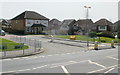
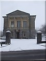
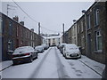
Photos of Dowlais Community

Area Information
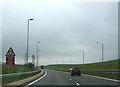
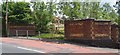
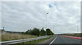
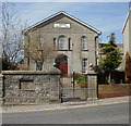
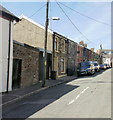
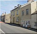
Living in Dowlais Community offers a distinct experience shaped by its history as a former ironworking hub. This civil parish, located in the county borough of Merthyr Tydfil in South Wales, spans 3.3 km². You will find yourselves stepping back in time as you walk past the Dowlais Conservation Area, which preserves the architectural legacy of the Dowlais Iron Company. The streets bear witness to the area's Victorian roots, featuring historic sites such as the Hebron Welsh Baptist Chapel and St Illtyd's Catholic Church, both listed for their architectural and historical significance. The name itself, derived from the Welsh words for black stream, hints at the industrial features that once defined the local economy. Daily life here reflects a quiet, residential pace. The village is situated approximately 51.7629°N and -3.3523°W, accessible via the surrounding road network. Formerly the home of thousands employed by the ironworks, the community has adapted since the closure of the major industrial works in the 1970s. Today, regeneration efforts led by the Welsh Development Agency have helped transform the landscape. You are living in an area where history meets modern comfort, offering a unique glimpse into Merthyr Tydfil's industrial past while providing a settled, parish-level geography for your future home.
- Area Type
- Parish
- Area Size
- 3.3 km²
- Population
- Not available
- Population Density
- Not available
Demographics
The community profile of Dowlais reflects an older, established population. The median age for residents stands at 70, indicating a village where many families or older generations remain settled rather than attracting a young workforce. This age demographic suggests a quieter environment compared to rapidly expanding urban fringes. Home ownership is prominent within the parish, with 51% of residents owning their homes outright. This figure typically correlates with longer-term stability and a community invested in the local estate. Accommodation types and household compositions in Dowlais align with the needs of an older population, though specific breakdowns between single, couple, or family households are not detailed in current records. The Catholic Church at St Illtyd's serves a significant portion of the spiritual life, reflecting historical migration patterns from the 19th century when Irish labourers arrived to work the iron furnaces. While the most common age range data indicates a broad spread across all categories, the concentration of residents over 70 defines the social rhythm. You should expect a neighbourhood where neighbours are likely long-standing friends, and community events often cater to retirees and established families rather than transient populations.
Household Size
Accommodation Type
Tenure
Ethnic Group
Religion
Household Composition
Age
Household Deprivation
NS-SEC
Explore more demographic insights in this area
Go to Demographics tabPlanning
Planning Constraints
- Flood RiskPremium
- Ramsar Wetland SitesPremium
- Area of Outstanding Natural BeautyPremium
- Protected Nature ReservePremium
- Protected WoodlandPremium
- Crime RiskPremium