Area Overview for CF48 4TU
Photos of CF48 4TU


Area Information
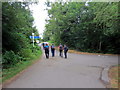
Living in CF48 4TU means being part of a small, tightly knit residential cluster in the Taff Valley, nestled 3 miles south of Merthyr Tydfil’s town centre. With a population of 2,097 spread across 15.4 hectares, this area combines a working-class heritage with modern living. The community’s history as a 19th-century coal mining village still lingers, though today it is a quiet, residential hub. Proximity to Merthyr Tydfil offers access to town amenities, while the surrounding countryside provides a contrast to urban life. Daily life here is shaped by a high population density of 1,291 people per square kilometre, fostering a close-knit atmosphere. The area’s compact size means amenities and services are within practical reach, though the lack of major infrastructure highlights its small-scale character. For those seeking a mix of history and convenience, CF48 4TU offers a snapshot of Wales’s industrial past and present.
- Area Type
- Postcode
- Area Size
- 15.4 hectares
- Population
- 2097
- Population Density
- 1291 people/km²
CF48 4TU is a predominantly owner-occupied area, with 72% of homes owned by residents rather than rented. The accommodation type is almost exclusively houses, indicating a focus on family homes rather than flats or apartments. This suggests a market geared towards long-term buyers seeking stability, though the small area size of 15.4 hectares limits the number of properties available. The high home ownership rate may reflect a desire for security in a community with a strong local identity. For buyers, this means competition for a limited number of properties, but also the potential for long-term value retention. The absence of rental properties suggests a market that prioritises homeownership over transient tenancy, aligning with the area’s historical roots as a working-class settlement.
House Prices in CF48 4TU
No properties found in this postcode.
Energy Efficiency in CF48 4TU
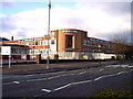
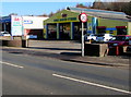
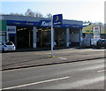
Daily life in CF48 4TU is shaped by its proximity to essential amenities and historical sites. Retail options include Iceland Merthyr, Co-op Pentrebach, and Aldi Twynyrodyn, ensuring access to groceries and everyday items. Rail connectivity to Merthyr Tydfil and nearby stations facilitates travel to work or leisure. The area’s historical character is evident in sites like the Saron Welsh Independent Chapel graveyard, maintained by community groups, and the remnants of 19th-century industrial heritage. While parks and leisure facilities are not explicitly listed, the compact size of the area means residents can walk or cycle to nearby green spaces. The blend of retail convenience, rail access, and historical interest creates a lifestyle that balances practicality with local identity.
Amenities
Schools
Residents of CF48 4TU have access to four schools within practical reach: Abercanaid Community School, Pentrebach Infants School, Greenfield Special School, and First Steps. These institutions cater to a range of educational needs, from early years to community-based learning. The presence of a special school and an infants’ school indicates a focus on supporting families through different stages of education. While the data does not include Ofsted ratings, the variety of school types suggests a comprehensive educational landscape. Families may benefit from the proximity of these schools, reducing travel time and fostering a sense of local cohesion. However, the lack of detailed performance data means potential buyers should investigate further into individual school standards.
| Rank | School | Type | Entry gender | Ages |
|---|
Explore more schools in this area
Go to Schools tabDemographics
The community in CF48 4TU is predominantly middle-aged, with a median age of 47 and 72% of residents owning their homes. The most common age group is adults aged 30–64, reflecting a stable, long-term population. Accommodation is largely in houses, with 72% of households being owner-occupied. The predominant ethnic group is White, and the area’s population density of 1,291 people per square kilometre suggests a compact, densely populated environment. This density may influence the pace of life, with fewer green spaces and more shared resources. The absence of specific deprivation data means quality of life is inferred from the high home ownership rate and the presence of local schools and amenities. The community’s demographic profile suggests a focus on family stability and long-term residency.
Household Size
Accommodation Type
Tenure
Ethnic Group
Religion
Household Composition
Age
Household Deprivation
NS-SEC
Explore more demographic insights in this area
Go to Demographics tabPlanning
Planning Constraints
- Flood RiskPremium
- Ramsar Wetland SitesPremium
- Area of Outstanding Natural BeautyPremium
- Protected Nature ReservePremium
- Protected WoodlandPremium
- Crime RiskPremium