Area Overview for CF48 2NQ
Photos of CF48 2NQ
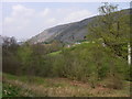
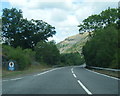
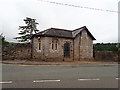


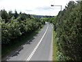
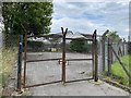


13 photos from this area
Area Information
Key information about the CF48 2NQ including its size, population, and administrative classification.
- Area Type
- Postcode
- Area Size
- 7908 m²
- Population
- 1934
- Population Density
- 509 people/km²
House Prices in CF48 2NQ
13
Properties
£220,350
Average Sold Price
£67,500
Lowest Price
£365,000
Highest Price
Showing 13 properties
| Address | Type | Beds | Baths | Last Sale Price | Last Sale Date | |
|---|---|---|---|---|---|---|
| Albion, Heol Y Mynydd, Cefn Coed, Merthyr Tydfil, CF48 2NQ | house | - | - | £345,000 | Aug 2022 | |
| Alamdra, Heol Y Mynydd, Cefn Coed, Merthyr Tydfil, CF48 2NQ | Detached | - | - | £365,000 | May 2021 | |
| Fairways, Heol Y Mynydd, Cefn Coed, Merthyr Tydfil, CF48 2NQ | house | - | - | £335,000 | Nov 2020 | |
| Ty Croeso, Heol Y Mynydd, Cefn Coed, Merthyr Tydfil, CF48 2NQ | Detached | 3 | 1 | £170,000 | Mar 2018 | |
| Delfryn, Heol Y Mynydd, Cefn Coed, Merthyr Tydfil, CF48 2NQ | Bungalow | - | - | £149,950 | Aug 2011 | |
| Yr-hafod, Heol Y Mynydd, Cefn Coed, Merthyr Tydfil, CF48 2NQ | Detached | - | - | £110,000 | Oct 2002 | |
| Caversham, Heol Y Mynydd, Cefn Coed, Merthyr Tydfil, CF48 2NQ | Land | - | - | £67,500 | Jun 1996 | |
| Cotham, Heol Y Mynydd, Cefn Coed, Merthyr Tydfil, CF48 2NQ | Detached | 3 | 1 | - | - | |
| Ty Gwyn, Heol Y Mynydd, Cefn Coed, Merthyr Tydfil, CF48 2NQ | Detached | - | - | - | - | |
| Eryl Taf, Heol Y Mynydd, Cefn Coed, Merthyr Tydfil, CF48 2NQ | Semi-detached | - | - | - | - |
Page 1 of 2
Energy Efficiency in CF48 2NQ
Amenities
Schools
| Rank | School | Type | Entry gender | Ages |
|---|
Explore more schools in this area
Go to Schools tabDemographics
Household Size
Two person
most common
Accommodation Type
Houses
most common
Tenure
71
majority
Ethnic Group
White
most common
Religion
N/A
most common
Household Composition
N/A
most common
Age
47
median
Adults (30-64 years)
most common
Household Deprivation
N/A
with no deprivation
NS-SEC
30
in Lower managerial occupations
Explore more demographic insights in this area
Go to Demographics tabPlanning
Planning Constraints
- Flood RiskPremium
- Ramsar Wetland SitesPremium
- Area of Outstanding Natural BeautyPremium
- Protected Nature ReservePremium
- Protected WoodlandPremium
- Crime RiskPremium