Area Overview for CF48 1YL
Photos of CF48 1YL


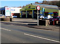
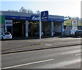


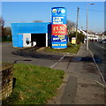
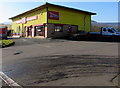
64 photos from this area
Area Information
Key information about the CF48 1YL including its size, population, and administrative classification.
- Area Type
- Postcode
- Area Size
- 12.7 hectares
- Population
- 2097
- Population Density
- 1291 people/km²
House Prices in CF48 1YL
15
Properties
£220,000
Average Sold Price
£20,000
Lowest Price
£370,000
Highest Price
Showing 15 properties
| Address | Type | Beds | Baths | Last Sale Price | Last Sale Date | |
|---|---|---|---|---|---|---|
| Webber House, Lewis Square, Abercanaid, Merthyr Tydfil, CF48 1YL | Detached | 5 | 4 | £370,000 | Aug 2024 | |
| Llys Canaid, Lewis Square, Abercanaid, Merthyr Tydfil, CF48 1YL | Semi-detached | 4 | 1 | £300,000 | Nov 2021 | |
| Pitwood House, Abercanaid Road, Abercanaid, Merthyr Tydfil, CF48 1YL | Detached | 4 | - | £190,000 | Apr 2015 | |
| Glyndyrus House, Abercanaid Road, Abercanaid, Merthyr Tydfil, CF48 1YL | Detached | - | - | £20,000 | May 1995 | |
| Pageant Sancerre Caravan, Glynderus Close, Abercanaid, Merthyr Tydfil, CF48 1YL | Mobile Home | - | - | - | - | |
| Clare House, Abercanaid Road, Abercanaid, Merthyr Tydfil, CF48 1YL | Detached | - | - | - | - | |
| The View-debonair Park Home, Glynderus Close, Abercanaid, Merthyr Tydfil, CF48 1YL | Mobile Home | - | - | - | - | |
| The Pump House-static Caravan, Quay Row, Abercanaid, Merthyr Tydfil, CF48 1YL | Mobile Home | - | - | - | - | |
| The Cabin - Park Home, Glynderus Close, Abercanaid, Merthyr Tydfil, CF48 1YL | Mobile Home | - | - | - | - | |
| Bailey Caravan, Glynderus Close, Abercanaid, Merthyr Tydfil, CF48 1YL | Mobile Home | - | - | - | - |
Page 1 of 2
Energy Efficiency in CF48 1YL
Amenities
Schools
| Rank | School | Type | Entry gender | Ages |
|---|
Explore more schools in this area
Go to Schools tabDemographics
Household Size
Two person
most common
Accommodation Type
Houses
most common
Tenure
72
majority
Ethnic Group
White
most common
Religion
N/A
most common
Household Composition
N/A
most common
Age
47
median
Adults (30-64 years)
most common
Household Deprivation
N/A
with no deprivation
NS-SEC
24
in Lower managerial occupations
Explore more demographic insights in this area
Go to Demographics tabPlanning
Planning Constraints
- Flood RiskPremium
- Ramsar Wetland SitesPremium
- Area of Outstanding Natural BeautyPremium
- Protected Nature ReservePremium
- Protected WoodlandPremium
- Crime RiskPremium