Area Overview for CF48 1DH
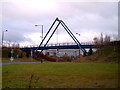
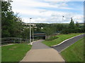
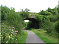
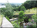
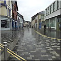
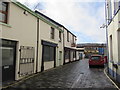
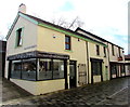
Photos of CF48 1DH


Area Information
CF48 1DH is a small, tightly knit residential cluster in the historic industrial heart of Merthyr Tydfil, Wales. With a population of 1,681 spread across 2.9 hectares, the area is densely populated, reflecting its long-standing role as a hub of ironworks activity. The postcode sits within the Cyfarthfa Heritage Area, a region defined by its 18th-century ironworks legacy, now preserved as a cultural and historical landmark. Residents live near the ruins of Cyfarthfa Ironworks, once a cornerstone of the Industrial Revolution, and within walking distance of Cyfarthfa Castle, a Grade I listed estate. Daily life here balances modern convenience with historical resonance. The area’s compact size means amenities are within practical reach, from nearby railway stations to local retail. Its proximity to Merthyr Tydfil’s town centre and the River Taff offers both urban connectivity and natural charm. The community is predominantly middle-aged, with a strong presence of families and long-term residents, shaped by the area’s industrial past and its ongoing preservation efforts.
- Area Type
- Postcode
- Area Size
- 2.9 hectares
- Population
- 1681
- Population Density
- 992 people/km²
The property market in CF48 1DH is dominated by owner-occupied homes, with 61% of properties owned outright. The area’s accommodation type is exclusively houses, not flats, which is uncommon in smaller postcodes. This suggests a housing stock tailored to families or individuals seeking more space, likely reflecting the historical development of the area as a residential cluster for industrial workers. The small size of the postcode—just 2.9 hectares—means the housing stock is limited, which could create competition among buyers. For those seeking properties, the focus is on existing homes rather than new builds, with little scope for expansion. The high home ownership rate implies a stable market, but buyers should consider the limited availability of properties and the potential for higher prices due to the area’s historical significance and compact nature.
House Prices in CF48 1DH
Showing 1 properties
| Address | Type | Beds | Baths | Last Sale Price | Last Sale Date | |
|---|---|---|---|---|---|---|
| Everything Everywhere Ltd, Rhydycar Business Park, Merthyr Tydfil, CF48 1DH | office_workshop | - | - | - | - |
Energy Efficiency in CF48 1DH
Living in CF48 1DH offers a blend of practicality and historical interest. The area’s retail options include Aldi Twynyrodyn, Farmfoods Twynyrodyn, and Iceland Merthyr, providing essential shopping within walking or short driving distance. These stores cater to daily needs, from groceries to household goods. The proximity to railway stations, such as Merthyr Tydfil and Pentre, ensures easy access to public transport, connecting residents to broader regional amenities. The Cyfarthfa Heritage Area itself is a key draw, with Cyfarthfa Castle and the remnants of the ironworks offering cultural and recreational value. The compact nature of the postcode means residents can access these features without long commutes, fostering a lifestyle that balances convenience with a connection to the area’s industrial past.
Amenities
Schools
| Rank | School | Type | Entry gender | Ages |
|---|
Explore more schools in this area
Go to Schools tabDemographics
The population of CF48 1DH has a median age of 47, with the majority of residents falling into the 30–64 age range. This suggests a community rooted in stability, with a significant proportion of working-age adults. Home ownership is high, at 61%, indicating a preference for long-term residency over rental properties. The area is predominantly composed of houses, not flats, which aligns with the higher proportion of owner-occupied homes. The predominant ethnic group is White, reflecting the broader demographic patterns of the region. The population density of 992 people per square kilometre is notably high for its small size, which may influence the character of the neighbourhood, fostering a close-knit environment. This density, combined with the age profile, suggests a community that values continuity and local ties over transient living arrangements.
Household Size
Accommodation Type
Tenure
Ethnic Group
Religion
Household Composition
Age
Household Deprivation
NS-SEC
Explore more demographic insights in this area
Go to Demographics tabPlanning
Planning Constraints
- Flood RiskPremium
- Ramsar Wetland SitesPremium
- Area of Outstanding Natural BeautyPremium
- Protected Nature ReservePremium
- Protected WoodlandPremium
- Crime RiskPremium