Area Overview for CF47 9TS
Photos of CF47 9TS


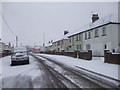
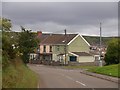

11 photos from this area
Area Information
Key information about the CF47 9TS including its size, population, and administrative classification.
- Area Type
- Postcode
- Area Size
- 4854 m²
- Population
- 1253
- Population Density
- 4472 people/km²
House Prices in CF47 9TS
15
Properties
£60,750
Average Sold Price
£22,250
Lowest Price
£95,000
Highest Price
Showing 15 properties
| Address | Type | Beds | Baths | Last Sale Price | Last Sale Date | |
|---|---|---|---|---|---|---|
| 50 Fourth Avenue, Galon Uchaf, Merthyr Tydfil, CF47 9TS | house | - | - | £95,000 | May 2022 | |
| 33 Fourth Avenue, Galon Uchaf, Merthyr Tydfil, CF47 9TS | Semi-detached | 2 | 2 | £65,000 | Jun 2018 | |
| 48 Fourth Avenue, Galon Uchaf, Merthyr Tydfil, CF47 9TS | house | 3 | - | £22,250 | Jun 2004 | |
| 31 Fourth Avenue, Galon Uchaf, Merthyr Tydfil, CF47 9TS | Semi-detached | 2 | 2 | - | - | |
| 39 Fourth Avenue, Galon Uchaf, Merthyr Tydfil, CF47 9TS | house | - | - | - | - | |
| 41 Fourth Avenue, Galon Uchaf, Merthyr Tydfil, CF47 9TS | house | - | - | - | - | |
| 52 Fourth Avenue, Galon Uchaf, Merthyr Tydfil, CF47 9TS | house | - | - | - | - | |
| 35 Fourth Avenue, Galon Uchaf, Merthyr Tydfil, CF47 9TS | house | - | - | - | - | |
| 37 Fourth Avenue, Galon Uchaf, Merthyr Tydfil, CF47 9TS | house | - | - | - | - | |
| 42 Fourth Avenue, Galon Uchaf, Merthyr Tydfil, CF47 9TS | house | - | - | - | - |
Page 1 of 2
Energy Efficiency in CF47 9TS
Amenities
Schools
| Rank | School | Type | Entry gender | Ages |
|---|
Explore more schools in this area
Go to Schools tabDemographics
Household Size
Family (3-5 people)
most common
Accommodation Type
Houses
most common
Tenure
44
majority
Ethnic Group
White
most common
Religion
N/A
most common
Household Composition
N/A
most common
Age
47
median
Adults (30-64 years)
most common
Household Deprivation
N/A
with no deprivation
NS-SEC
11
in Lower managerial occupations
Explore more demographic insights in this area
Go to Demographics tabPlanning
Planning Constraints
- Flood RiskPremium
- Ramsar Wetland SitesPremium
- Area of Outstanding Natural BeautyPremium
- Protected Nature ReservePremium
- Protected WoodlandPremium
- Crime RiskPremium