Area Overview for CF47 9HL
Photos of CF47 9HL
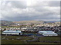

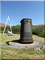
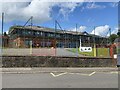

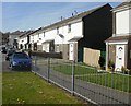
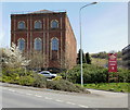

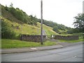
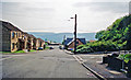

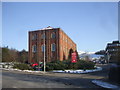
26 photos from this area
Area Information
Key information about the CF47 9HL including its size, population, and administrative classification.
- Area Type
- Postcode
- Area Size
- 2.8 hectares
- Population
- 1172
- Population Density
- 7772 people/km²
House Prices in CF47 9HL
32
Properties
£97,407
Average Sold Price
£11,500
Lowest Price
£155,550
Highest Price
Showing 32 properties
| Address | Type | Beds | Baths | Last Sale Price | Last Sale Date | |
|---|---|---|---|---|---|---|
| 21 Gellifaelog Terrace, Penydarren, Merthyr Tydfil, CF47 9HL | Terraced | 4 | 2 | £133,000 | Jun 2025 | |
| 12 Gellifaelog Terrace, Penydarren, Merthyr Tydfil, CF47 9HL | Terraced | 3 | 1 | £120,000 | Feb 2025 | |
| 9 Gellifaelog Terrace, Penydarren, Merthyr Tydfil, CF47 9HL | house | - | - | £155,550 | Aug 2024 | |
| 22 Gellifaelog Terrace, Penydarren, Merthyr Tydfil, CF47 9HL | Terraced | 3 | 1 | £150,000 | Jun 2024 | |
| 28 Gellifaelog Terrace, Penydarren, Merthyr Tydfil, CF47 9HL | Terraced | 3 | 1 | £105,000 | May 2023 | |
| 14 Gellifaelog Terrace, Penydarren, Merthyr Tydfil, CF47 9HL | Terraced | 3 | 1 | £145,000 | Apr 2023 | |
| 10 Gellifaelog Terrace, Penydarren, Merthyr Tydfil, CF47 9HL | Terraced | 3 | 1 | £85,000 | Dec 2020 | |
| 18 Gellifaelog Terrace, Penydarren, Merthyr Tydfil, CF47 9HL | Terraced | 3 | 1 | £116,000 | Aug 2020 | |
| 3 Gellifaelog Terrace, Penydarren, Merthyr Tydfil, CF47 9HL | Terraced | 3 | 2 | £96,000 | May 2020 | |
| 1A Gellifaelog Terrace, Penydarren, Merthyr Tydfil, CF47 9HL | house | - | - | £117,000 | Jan 2020 |
Page 1 of 4
Energy Efficiency in CF47 9HL
Amenities
Schools
| Rank | School | Type | Entry gender | Ages |
|---|
Explore more schools in this area
Go to Schools tabDemographics
Household Size
Family (3-5 people)
most common
Accommodation Type
Houses
most common
Tenure
60
majority
Ethnic Group
White
most common
Religion
N/A
most common
Household Composition
N/A
most common
Age
47
median
Adults (30-64 years)
most common
Household Deprivation
N/A
with no deprivation
NS-SEC
20
in Lower managerial occupations
Explore more demographic insights in this area
Go to Demographics tabPlanning
Planning Constraints
- Flood RiskPremium
- Ramsar Wetland SitesPremium
- Area of Outstanding Natural BeautyPremium
- Protected Nature ReservePremium
- Protected WoodlandPremium
- Crime RiskPremium