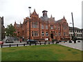
Area Overview for CF47 8SW
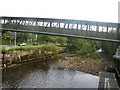
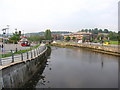
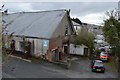
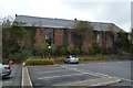
Photos of CF47 8SW


Area Information
Parking Community sits within the civil parish of Merthyr Tydfil County Borough in Wales, centred on coordinates 51.749045, -3.383324. This postcode area covers a small residential cluster measuring 5,841 square metres. You will find roughly 1,423 residents living in this compact space, creating a density of 973 people per square kilometre. This location forms part of a town historically defined by ironworking, situated approximately 23 miles north of Cardiff. Penydarren Park anchors the local landscape, serving as home to Merthyr Town Football Club since 1908 and overlaying the remains of a Roman military fort discovered during 18th-century construction. The area connects to key recreational sites like Cyfarthfa Park, which welcomes over 500,000 visitors annually. Daily life here balances proximity to industrial heritage with access to leisure facilities. You can reach Merthyr Tydfil Railway Station and other transport hubs within practical reach. Living in CF47 8SW means residing in a specific postcode area that maintains clear boundaries while offering direct access to the broader town's infrastructure and historical attractions. The environment reflects a blend of sporting venues, historic parks, and residential pockets defined by their close-kilted nature.
- Area Type
- Postcode
- Area Size
- 5841 m²
- Population
- 1423
- Population Density
- 973 people/km²
This small residential cluster reflects a strong preference for traditional housing within a defined boundary. Almost four out of every five households own their property, standing at 79 per cent ownership. This statistic confirms that CF47 8SW is an owner-occupied area rather than a letting estate. Houses form the predominant accommodation type, meaning you will find terraced or detached dwellings rather than apartment blocks. The market here is localised by the area's small size of 5,841 square metres. Prospective buyers should expect a stock suited to families and established workers. The high ownership percentage suggests that resale prices are often held by long-term residents. Limited turnover could mean fewer full listings at any given time. If you are looking at homes in CF47 8SW, you are entering a market where private ownership drives value. The dominance of houses aligns with the area's demographic of adults aged 30 to 64. You may find more established properties suitable for growing families than modern developments. This structure supports a stable residential environment with minimal transitory occupancy.
House Prices in CF47 8SW
Showing 23 properties
| Address | Type | Beds | Baths | Last Sale Price | Last Sale Date | |
|---|---|---|---|---|---|---|
| 16 Hanover Street, Merthyr Tydfil, CF47 8SW | Terraced | 3 | 1 | £135,000 | Jun 2025 | |
| 13 Hanover Street, Merthyr Tydfil, CF47 8SW | Terraced | 4 | 1 | £167,500 | Jul 2023 | |
| 20 Hanover Street, Merthyr Tydfil, CF47 8SW | Terraced | 3 | - | £137,000 | Jul 2019 | |
| 15 Hanover Street, Merthyr Tydfil, CF47 8SW | Terraced | 3 | 1 | £108,000 | Apr 2018 | |
| 19 Hanover Street, Merthyr Tydfil, CF47 8SW | Terraced | 3 | 1 | £70,000 | Oct 2016 | |
| 31 Hanover Street, Merthyr Tydfil, CF47 8SW | house | 3 | - | £125,000 | Feb 2015 | |
| 14 Hanover Street, Merthyr Tydfil, CF47 8SW | Terraced | 3 | - | £93,500 | Aug 2013 | |
| Lyndhurst, 23 Hanover Street, Merthyr Tydfil, CF47 8SW | Terraced | - | - | £88,000 | Oct 2007 | |
| 18 Hanover Street, Merthyr Tydfil, CF47 8SW | house | - | - | £25,000 | May 2000 | |
| 9 Hanover Street, Merthyr Tydfil, CF47 8SW | Terraced | - | - | £33,000 | Feb 1996 |
Energy Efficiency in CF47 8SW
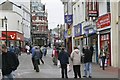
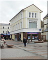
Retail and transport options cluster very close to the CF47 8SW postcode. You have access to five retail venues nearby, including Spar, M&S Merthyr, and Iceland Merthyr. These shops form the local high street for daily groceries and essentials. Transport links are equally accessible with five rail stations in reach. Merthyr Tydfil Railway Station serves as a major interchange point for trips to Cardiff and beyond. Pentre and Troedyrhiw Railway Stations offer alternative connections within the system. This dual coverage of shops and trains means you can shop or commute without needing a car. Living in this area places you in close proximity to Merthyr Tydfil's core amenities. You can reach the 500,000 annual visitors drawn to Cyfarthfa Park by using these transport links. The presence of Spar and Iceland ensures weekly shopping is convenient. Five railway stations connected within short travel time define the lifestyle here. Homes in CF47 8SW benefit from this immediate access to commerce and public transport networks.
Amenities
Schools
Several education institutions serve the CF47 8SW locality. You can access Gurnos Nursery School, which offers early years education. Cyfarthfa Park Primary School stands nearby, providing primary instruction to children in the catchment. Brecon Road Infants School caters to younger pupils with infant education. St Aloysius Primary School offers additional primary options for families living in this postcode. All these schools are listed as other institutions in the immediate vicinity. The mix includes nurseries and primary schools, catering to children from nursery entry through to end-of-Key Stage 2. Living in this area places you close to a network of educational providers. You have access to four distinct schools within practical reach. Families with young children will find suitable schooling options without needing to travel far. The presence of primary institutions supports families looking for education within the neighbourhood without commuting to larger towns. Schools near CF47 8SW provide a localised educational environment for the 1,423 residents of the cluster.
| Rank | School | Type | Entry gender | Ages |
|---|
Explore more schools in this area
Go to Schools tabDemographics
The community in CF47 8SW is dominated by adults aged between 30 and 64 years. Your neighbours are likely to be in this prime working and family-building age bracket. The median age for residents is 47 years, indicating a mature population compared to national averages. Around 79 per cent of households own their homes outright. This high ownership rate shapes the stability of the local neighbourhood. The area primarily consists of houses rather than flats. Most residents identify as White, reflecting the traditional demographic of this part of Wales. The population density of 973 people per square kilometre means you will live close to others within this 5,841 square metre zone. You can expect interactions with adults who have likely raised families or established careers. The age profile suggests a stable environment where long-term residents form the core of the community. Living in CF47 8SW involves joining a neighbourhood where ownership is the norm and family life is central to the daily rhythm of the estate.
Household Size
Accommodation Type
Tenure
Ethnic Group
Religion
Household Composition
Age
Household Deprivation
NS-SEC
Explore more demographic insights in this area
Go to Demographics tabPlanning
Planning Constraints
- Flood RiskPremium
- Ramsar Wetland SitesPremium
- Area of Outstanding Natural BeautyPremium
- Protected Nature ReservePremium
- Protected WoodlandPremium
- Crime RiskPremium