Area Overview for CF47 0EU
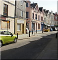
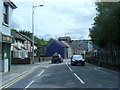
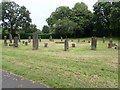
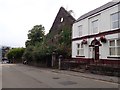
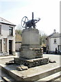
Photos of CF47 0EU


Area Information
CF47 0EU represents a specific residential cluster within the civil parish of Merthyr Tydfil, covering just 1.1 hectares. This small, highly concentrated area supports a population of 1436 people, resulting in a population density of 134,673 people per square kilometre. Living in CF47 0EU means residing in one of the most densely populated postcode sectors in the United Kingdom. The area is situated approximately 23 miles north of Cardiff, within a region that evolved from rural farming to an industrial powerhouse driven by iron and coal. While the postcode represents a tiny geographical footprint, it forms part of a community with deep historical roots dating back to prehistoric settlement and the dramatic industrial growth of the late 18th century. The modern town emerged rapidly after the 1740s when land was leased for iron smelting, leading to a massive population boom by the 19th century. Today, the area sits within this established urban character, offering residents a compact living environment close to the town's historic landmarks and industrial heritage sites.
- Area Type
- Postcode
- Area Size
- 1.1 hectares
- Population
- 1436
- Population Density
- 5779 people/km²
Homes in CF47 0EU form part of a predominantly owner-occupied market, with 68% of dwellings title-held by residents. Houses are the main form of accommodation, which is typical for this type of small, high-density cluster in South Wales. This high level of ownership suggests that the housing stock consists largely of long-term family homes rather than short-term rentals. For buyers looking at this postcode, the market reflects the wider trends of the Merthyr Tydfil area, where industrial history has given way to stable communities. The small area size of 1.1 hectares limits the total number of available properties, meaning competition for suitable homes can be keen. Prospective purchasers should note that while the specific data for valuation or sales prices is not provided, the demographic profile points towards a mature housing stock. The fact that two-thirds of residents own their homes implies that renovation and maintenance systems are well established. Buyers can expect a neighbourhood where property values have likely risen as the industrial land has been repurposed for domestic use over recent decades.
House Prices in CF47 0EU
Showing 16 properties
Energy Efficiency in CF47 0EU
Your daily life in CF47 0EU is supported by a compact range of amenities located within easy walking or driving distance. For shopping needs, there are five retail locations nearby, including notable venues such as Tesco Merthyr, Farmfoods Twynyrodyn, and Iceland Merthyr. These supermarkets provide all necessities from fresh produce to household goods, ensuring you rarely need to travel far for groceries. Travel convenience is enhanced by rail connectivity, with five stations in the immediate vicinity including Merthyr Tydfil Railway Station, Pentre, and Troedyrhiw Railway Station. These transport hubs offer frequent services to Cardiff and the rest of Wales. While specific restaurant listings or leisure parks are not detailed in the available data, the presence of major retailers and train stations suggests a self-contained lifestyle. The area allows you to shop, travel, and run errands without leaving the local cluster. The history of the area, including its Roman fort remains and football club, adds a cultural layer to your weekend activities in Merthyr Tydfil.
Amenities
Schools
Educational provisions for families living near CF47 0EU are centred around Twynyrodyn Junior School. This establishment serves as the primary educational option listed for the immediate vicinity, providing early years education for young children in the Merthyr Tydfil area. While detailed Ofsted ratings or full inspection reports are not included in the current dataset, the presence of this school indicates a committed local education system. The school type is classified as 'other', which refers to the specific categorisation provided for this institution within the local authority framework. Families in this postcode must look beyond this single listed option if they require secondary education, as the data does not provide names for high schools or sixth form colleges. However, the presence of Twynyrodyn Junior School confirms that early schooling is accessible without resorting to school travel from further afield. The concentration of 1436 residents in such a small area ensures that local schools remain relevant to the immediate community needs. Prospective parents should consult the local council directly for the most up-to-date inspection statuses and curriculum details for Twynyrodyn Junior School.
| Rank | School | Type | Entry gender | Ages |
|---|
Explore more schools in this area
Go to Schools tabDemographics
The community in CF47 0EU is defined by a mature population profile with a median age of 47. Residents are predominantly adults between the ages of 30 and 64, suggesting a neighbourhood where young families and those in their prime earning years are key constituents. Around 68% of residents own their homes, indicating a stable, settled population rather than a transient rental community. Houses form the principal accommodation type, aligning with the area's status as part of the broader Merthyr Tydfil fabric. The predominant ethnic group is White, which reflects the demographic composition typical of the region. Given the high level of home ownership and the concentration of adults in middle age, the area likely caters to individuals who have stayed in one place for a significant period. This stability contributes to a quiet residential atmosphere where neighbours often know each other well. The high density of 134,673 people per square kilometre ensures that daily amenities are within easy reach, even though the physical size of the cluster is extremely small.
Household Size
Accommodation Type
Tenure
Ethnic Group
Religion
Household Composition
Age
Household Deprivation
NS-SEC
Explore more demographic insights in this area
Go to Demographics tabPlanning
Planning Constraints
- Flood RiskPremium
- Ramsar Wetland SitesPremium
- Area of Outstanding Natural BeautyPremium
- Protected Nature ReservePremium
- Protected WoodlandPremium
- Crime RiskPremium