Area Overview for CF46 6SH
Photos of CF46 6SH


Area Information
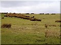
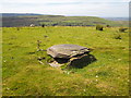
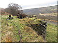
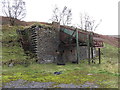
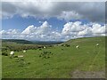
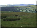
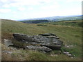
Living in Bedlinog means residing in a small village located in the north-east corner of Merthyr Tydfil County Borough, Wales. This specific postcode area covers a distinct 3.2 km², creating a tightly knit residential cluster with a population of just 1,358. The character of the village is defined by its dramatic physical landscape, where terraced houses cling to the hillside at unusual angles. Bedlinog existed for centuries as farmland before modern development established the settlement centre historically known as Cwmfelin in the 1830s. The community expanded significantly following the sinking of Bedlinog Colliery in 1874, which was sunk by the Dowlais Iron Company at a cost of £131,000. Today, the area retains the resilience and strong social fabric of a traditional mining village while accommodating a modern demographic of over 40-year-olds. The village sits within the CF46 postcode area, offering a quiet alternative to the busy industrial towns nearby. Residents navigate a steep terrain that gives the settlement its unique architectural identity. The history of the area is deeply rooted in the industrial past, with four large chapels constructed between 1876 and 1889 to serve the growing workforce. These chapels, alongside the original Salem Chapel from 1830, remain notable features of the local environment. Living here connects you to a rich heritage while providing the peace of a rural community with a population density of just 101 people per square kilometre.
- Area Type
- Postcode
- Area Size
- 3.2 km²
- Population
- 1358
- Population Density
- 101 people/km²
This postcode area functions primarily as an owner-occupied market rather than a rental hotspot. Data confirms that 71% of properties are in private ownership, meaning the local housing stock is firmly established by current residents. The predominant accommodation type is houses, which fits the village's history of terraced housing built for coal miners in the late 19th century. Prospective buyers looking at this small area should expect to compete with homeowners looking to upgrade or relocate their families rather than face competition from short-term landlords. The density of 1358 people across 3.2 km² suggests limited available land for new large-scale developments. Existing homes in CF46 6SH likely command premiums for being located in a heritage-rich mining village with distinctive architecture. The mix of houses on steep terrain may affect maintenance costs and accessibility for some buyers. Potential purchasers should understand that buying a property here often means entering a long-held family estate where retention is common. Homes in CF46 6SH represent a specific niche within the wider Merthyr Tydfil market. The lack of rental pressure allows sellers to maintain prices based on property condition and location within the valley rather than investment yield potential. Buyers seeking character properties with historical connections to the Dowlais Iron Company and Bedlinog Colliery may find limited but unique stock available. The market moves slowly due to the population size and low turnover typical of such a historic village.
House Prices in CF46 6SH
Showing 3 properties
| Address | Type | Beds | Baths | Last Sale Price | Last Sale Date | |
|---|---|---|---|---|---|---|
| Coly-isaf Farm, Pleasant View, Bedlinog, Treharris, CF46 6SH | Terraced | - | - | - | - | |
| Coly-uchaf Farm, Pleasant View, Bedlinog, Treharris, CF46 6SH | house | - | - | - | - | |
| Tir-y-colly House, Pleasant View, Bedlinog, Treharris, CF46 6SH | Detached | - | - | - | - |
Energy Efficiency in CF46 6SH
Daily life in CF46 6SH revolves around the village centre and the amenities within walking distance or short driving range. Residents have access to five retail outlets including Morrisons Daily, Co-op Pentrebach, and Iceland Merthyr, ensuring basic grocery needs are met easily. The presence of these specific stores reduces the need for long trips to larger urban centres for everyday shopping. Five railway stations are located nearby, providing regular rail links to wider networks without requiring a journey into Merthyr Tydfil town centre first. The character of the village is shaped by its four major chapels built between 1876 and 1889, which create a strong sense of community identity. Salem Chapel dates back to 1830, standing as a testament to the village's historic spiritual centre. Living here connects you to a community that maintained its social structures through significant industrial challenges in the 1930s. The historical resilience of the population continues to influence the open and neighbourly atmosphere of the locality today. Contact sports and outdoor activities are naturally suited to the steep, dramatic landscape. The area contains no protected nature reserves or Ramsar wetland sites, allowing for flexible land use while maintaining local green spaces. The absence of AONB status means planning constraints are relatively low compared to designated beauty spots, though protected woodland does exist within the boundaries. This mix of natural features provides residents with a backdrop of rolling hills and historic terraces that define the visual experience of life in Bedlinog.
Amenities
Schools
Families considering homes in CF46 6SH have access to Bedlinog Community Primary School as the nearest educational facility. This school serves as the main provision for younger children living in the village and its immediate surroundings. While the school type is listed as 'other' in current data, it forms the primary educational link for the local community. Parents in this postcode often look toward Pontypridd or Treharris for secondary education given the village's size, though specific secondary school names are not detailed in the available information for this area. The presence of a single primary school reflects the small population of 1,358 residents. Living in CF46 6SH means you are part of a close-knit educational catchment where children will likely spend their early school years within a familiar environment. The school is situated to serve the terraced housing clusters that branch off the main village centre. For those prioritising education, this configuration requires careful planning regarding secondary school placement as the village itself does not host a larger comprehensive or academy institution. Schools near CF46 6SH are selected based on proximity and catchment boundaries typical of rural communities. The reliance on one primary school simplifies the school run for local families but may necessitate car travel for many children to reach secondary destinations. Parents should verify specific admission criteria and catchment zones with the school or Merthyr Tydfil County Borough Council before securing a home purchase. The educational provision aligns with the village's historic function as a tight community unit rather than a broader urban hub.
| Rank | School | Type | Entry gender | Ages |
|---|
Explore more schools in this area
Go to Schools tabDemographics
The community in CF46 6SH reflects the settled nature of a traditional Welsh village. The median age stands at 47, with the most common age range being adults between 30 and 64 years old. This demographic profile indicates a neighbourhood dominated by established families and long-term residents rather than transient populations. Home ownership is high, with 71% of dwellings owned outright or with a mortgage. This significant majority makes mortgage quang arbitrage difficult as most homes are already occupied by their owners. Accommodation within this postcode consists almost entirely of houses, aligning with the historical development patterns of the region. While specific data on household size is not provided, the age distribution suggests a balance between working-age adults and those nearing retirement. The predominant ethnic group is White, which mirrors the typical makeup of communities in Merthyr Tydfil County Borough. The low population density of 101 people per square kilometre contributes to a less crowded living environment compared to urban centres. Living in CF46 6SH offers a stable community feeling where neighbours often know each other well. The high home ownership rate implies residents have strong ties to their local homes and may be less willing to move frequently. The age structure suggests a quiet evenings atmosphere as younger children are less common than in suburban housing estates. Families living here likely value the maturity of the surrounding community and the absence of high-density housing blocks.
Household Size
Accommodation Type
Tenure
Ethnic Group
Religion
Household Composition
Age
Household Deprivation
NS-SEC
Explore more demographic insights in this area
Go to Demographics tabPlanning
Planning Constraints
- Flood RiskPremium
- Ramsar Wetland SitesPremium
- Area of Outstanding Natural BeautyPremium
- Protected Nature ReservePremium
- Protected WoodlandPremium
- Crime RiskPremium