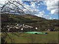
Area Overview for Aberfan
Photos of Aberfan
Area Information
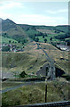
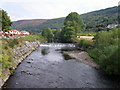
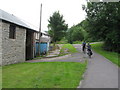
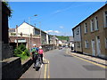
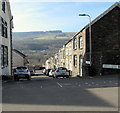
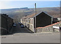
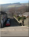
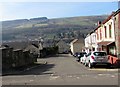
Aberfan, a built-up area in Wales, spans 50.4 hectares and is home to a population with a median age of 70. This suggests a community shaped by older residents, which may influence local services and social dynamics. The area’s compact size makes it accessible, with nearby amenities like rail stations and retail outlets within practical reach. Aberfan’s character is defined by its modest scale and the presence of essential infrastructure, including schools and shops. While it lacks the density of larger cities, it offers a quieter, more localized living experience. For those seeking a place with a strong sense of community and proximity to daily necessities, Aberfan provides a straightforward, no-frills environment. Its appeal lies in simplicity, with a focus on practical living rather than grandeur. The area’s demographics and amenities cater to those prioritizing convenience over urban vibrancy, making it a viable option for buyers looking for a stable, low-maintenance location.
- Area Type
- Built Up Area 250
- Area Size
- 50.4 hectares
- Population
- Not available
- Population Density
- Not available
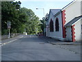
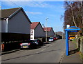
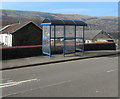
Aberfan’s residents have access to five rail stations, including Merthyr Vale and Troedyrhiw, facilitating travel to nearby towns and cities. The area’s retail scene includes five notable stores: Morrisons Daily, Iceland Mountain, and Co-op Penrhwiceiber, providing a range of grocery and convenience options. While the data does not specify dining or leisure venues, the presence of these shops suggests a functional, community-focused lifestyle. The compact nature of the area means amenities are within walking or short driving distance, enhancing daily convenience. For those prioritising practicality over luxury, Aberfan offers a straightforward living experience with essential services readily available.
Amenities
Schools
The nearest school to Aberfan is Ynysowen Community Primary School, which is categorised as an "other" type. No further details on its Ofsted rating or educational focus are provided, so its quality and performance remain unclear. Families with children may need to consider additional options beyond this single school, as no other institutions are listed in the data. The limited number of schools suggests that parents might need to look further afield for secondary education or specialist provisions. This could be a factor for prospective buyers prioritising proximity to educational facilities, though the available data does not confirm the school’s effectiveness or reputation.
| Rank | A + A* % | School | Type | Entry gender | Ages |
|---|---|---|---|---|---|
| 1 | N/A | Ynysowen Community Primary School | other | N/A | N/A |
Explore more schools in this area
Go to Schools tabDemographics
Aberfan’s population has a median age of 70, the highest in the dataset, indicating a predominantly older demographic. This age profile suggests a community with a significant proportion of retired individuals, which may influence local services and social activities. Home ownership in the area is 60%, meaning 40% of residents rent their homes. The accommodation types and household compositions are not specified, but the data implies a mix of housing stock. The area’s demographic makeup does not include specific details on ethnic or religious diversity, so broader generalisations are not possible. The older age range may contribute to a more settled, low-turnover community, which could be a consideration for buyers evaluating long-term stability. However, the lack of detailed data on deprivation or diversity means the full picture of quality of life remains partially unexplored.
Household Size
Accommodation Type
Tenure
Ethnic Group
Religion
Household Composition
Age
Household Deprivation
NS-SEC
Explore more demographic insights in this area
Go to Demographics tabPlanning
Planning Constraints
- Crime RiskLocked