Area Overview for Gurnos Community
Photos of Gurnos Community


Area Information
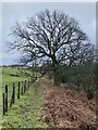
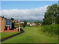
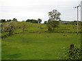
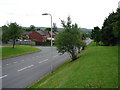
Gurnos Community is a civil parish located in Merthyr Tydfil, Wales, covering an area of 1.5 square kilometres. This site sits at coordinates 51.761528, -3.376214 and bears the postcode CF47 9XF. The land developed on what was once Gurnos Farm, the largest property within the borough. Historically, this site hosted a mill, cottages, and a stream until the early 1950s when authorities transformed it into a housing estate. The original farm housed Welsh mountain ponies until the 1970s. During the estate's expansion in the 1970s, planners notably removed the Gurnos Tavern and maisonette flats to create new green spaces. Historian links suggest the name derives from ancient Welsh, possibly meaning place of cairns or night fold. A 1716 sale record included Melin y Gyrnos mill, while later records show management by Cyfarthfa Ironworks. The estate itself was established by Merthyr Tydfil Council on previously inhabited farmland. Streets now bear names such as Oak Road, Acacia, and Rowan, referencing the former wooded character of the land. You will find The Prince Charles Hospital nearby, which opened in 1978. Goitre Pond also sits within the community, though it carries a reputation for being a dangerous swimming location. Living in Gurnos Community means navigating a landscape defined by this layered industrial and agricultural history.
- Area Type
- Parish
- Area Size
- 1.5 km²
- Population
- Not available
- Population Density
- Not available
Demographics
The population living in Gurnos Community reflects deep changes over recent decades. Evidence indicates a median age of 70 years, placing the community among the oldest residential areas in Wales. This average age profile suggests a population with significant experience and a lack of younger working-age residents. Reports place the total population at 5,280 according to the 2011 census, creating the largest housing estate in Northern Europe. Despite stereotypes surrounding the area, any demographic data on household composition, predominant ethnic groups, or religion is not included in the provided records. You rely on the broad age statistic to understand the scale of the community. Home ownership stands at 39%, indicating a majority lives in rented or other non-owned accommodation. Of the total number of households recorded for the parish, this figure shapes the rental landscape you encounter. Anyone considering buying a home must accept that ownership is a minority statistic here. The area accommodates three continuous age bands with a 70-year median, regardless of specific percentage breakdowns. This demographic reality creates a specific social environment that differs sharply from typical family-oriented estates. The total population figure and the high median age define the character of daily life for those residing here.
Household Size
Accommodation Type
Tenure
Ethnic Group
Religion
Household Composition
Age
Household Deprivation
NS-SEC
Explore more demographic insights in this area
Go to Demographics tabPlanning
Planning Constraints
- Flood RiskPremium
- Ramsar Wetland SitesPremium
- Area of Outstanding Natural BeautyPremium
- Protected Nature ReservePremium
- Protected WoodlandPremium
- Crime RiskPremium